File:Virginia-peninsula.png
Size of this preview: 717 × 600 pixels. Other resolutions: 287 × 240 pixels | 574 × 480 pixels | 1,022 × 855 pixels.
Original file (1,022 × 855 pixels, file size: 147 KB, MIME type: image/png)
| This is a file from the Wikimedia Commons. The description on its description page there is shown below.
|
Summary
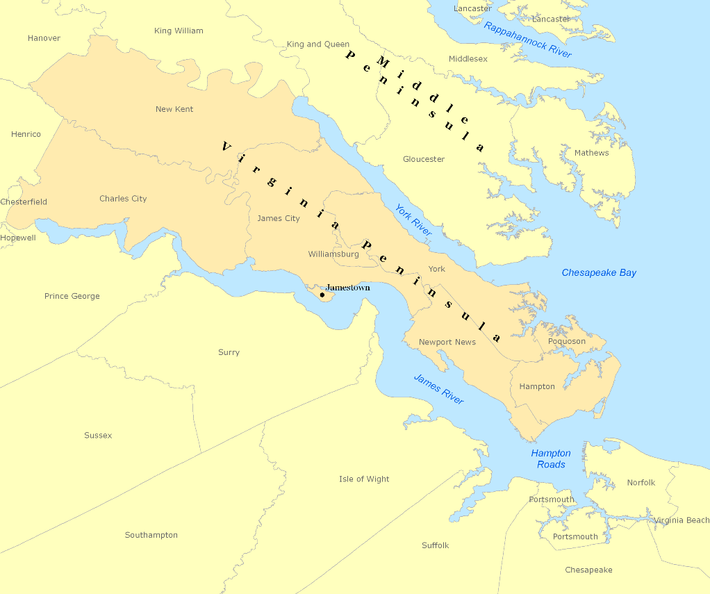
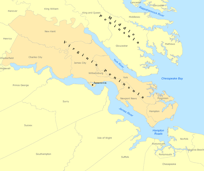
| Description | Map of the Virginia Peninsula created with Arcview |
| Date | |
| Source | ESRI/Teleatlas/GDI |
| Author | Andrew Wiseman |
Licensing
I, the copyright holder of this work, hereby publish it under the following licenses:

|
Permission is granted to copy, distribute and/or modify this document under the terms of the GNU Free Documentation License, Version 1.2 or any later version published by the Free Software Foundation; with no Invariant Sections, no Front-Cover Texts, and no Back-Cover Texts. A copy of the license is included in the section entitled GNU Free Documentation License. |
This file is licensed under the Creative Commons Attribution 3.0 Unported license.
- You are free:
- to share – to copy, distribute and transmit the work
- to remix – to adapt the work
- Under the following conditions:
- attribution – You must give appropriate credit, provide a link to the license, and indicate if changes were made. You may do so in any reasonable manner, but not in any way that suggests the licensor endorses you or your use.
You may select the license of your choice.
File history
Click on a date/time to view the file as it appeared at that time.
| Date/Time | Dimensions | User | Comment | |
|---|---|---|---|---|
| current | 08:41, 7 March 2008 | 1,022 × 855 (147 KB) | Awiseman | {{Information |Description=Map of the Virginia Peninsula created with Arcview |Source=ESRI/Teleatlas/GDI |Date=3-7-08 |Author=Andrew Wiseman |Permission= |other_versions= }} |
File usage
The following page uses this file: