File:Wilkes campsite.jpg
Size of this preview: 800 × 522 pixels. Other resolutions: 320 × 209 pixels | 640 × 418 pixels | 1,024 × 668 pixels | 1,280 × 835 pixels | 2,931 × 1,913 pixels.
Original file (2,931 × 1,913 pixels, file size: 4.08 MB, MIME type: image/jpeg)
| This is a file from the Wikimedia Commons. The description on its description page there is shown below.
|
|
This is an image of a place or building that is listed on the National Register of Historic Places in the United States of America. Its reference number is 74000295. |
Summary
| Description |
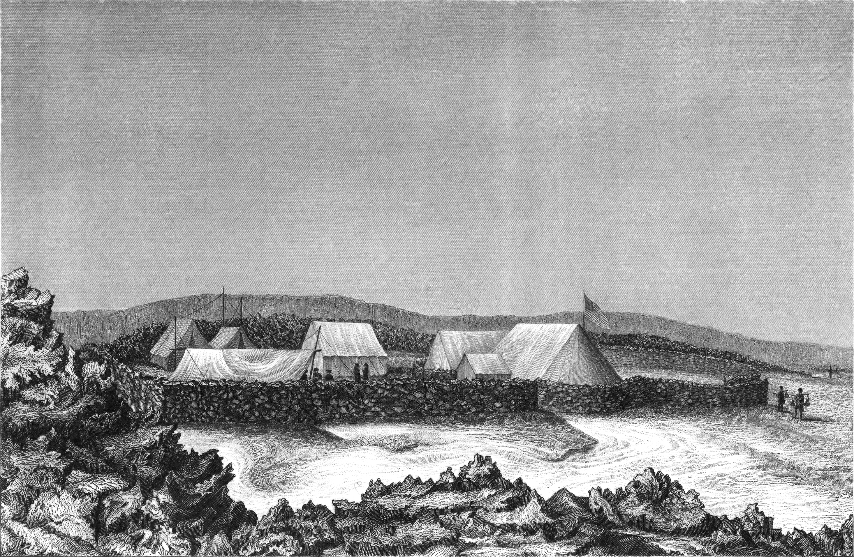
English: Wilkes Campsite — Illustration from Lt. Charles Wilkes journal of the U.S. Exploratory Expedition, January 1841 by ship artist Alfred Thomas Agate of their camp site at Mokuaweoweo, the summit of Mauna Loa. |
| Date | |
| Source | David Rumsey Historical Map Collection |
| Author | Sketch by Charles Wilkes. Engraved by J.N. Gimbrede. |
| Camera location | | View this and other nearby images on: OpenStreetMap |
|---|
Licensing
This work is in the public domain in the United States because it is a work prepared by an officer or employee of the United States Government as part of that person’s official duties under the terms of Title 17, Chapter 1, Section 105 of the US Code.
Note: This only applies to original works of the Federal Government and not to the work of any individual U.S. state, territory, commonwealth, county, municipality, or any other subdivision. This template also does not apply to postage stamp designs published by the United States Postal Service since 1978. (See § 313.6(C)(1) of Compendium of U.S. Copyright Office Practices). It also does not apply to certain US coins; see The US Mint Terms of Use.
|
 | |
| This file has been identified as being free of known restrictions under copyright law, including all related and neighboring rights. | ||
This file is a work of a sailor or employee of the U.S. Navy, taken or made as part of that person's official duties. As a work of the U.S. federal government, it is in the public domain in the United States.
|
 | |
| This file has been identified as being free of known restrictions under copyright law, including all related and neighboring rights. | ||
File history
Click on a date/time to view the file as it appeared at that time.
| Date/Time | Dimensions | User | Comment | |
|---|---|---|---|---|
| current | 13:46, 23 March 2012 | 2,931 × 1,913 (4.08 MB) | Kaidor | Larger image |
File usage
The following 2 pages use this file: