File:Wyspy Normandzkie.png
Size of this preview: 430 × 600 pixels. Other resolutions: 172 × 240 pixels | 344 × 480 pixels | 550 × 768 pixels | 734 × 1,024 pixels | 1,419 × 1,980 pixels.
Original file (1,419 × 1,980 pixels, file size: 293 KB, MIME type: image/png)
| This is a file from the Wikimedia Commons. The description on its description page there is shown below.
|
Summary
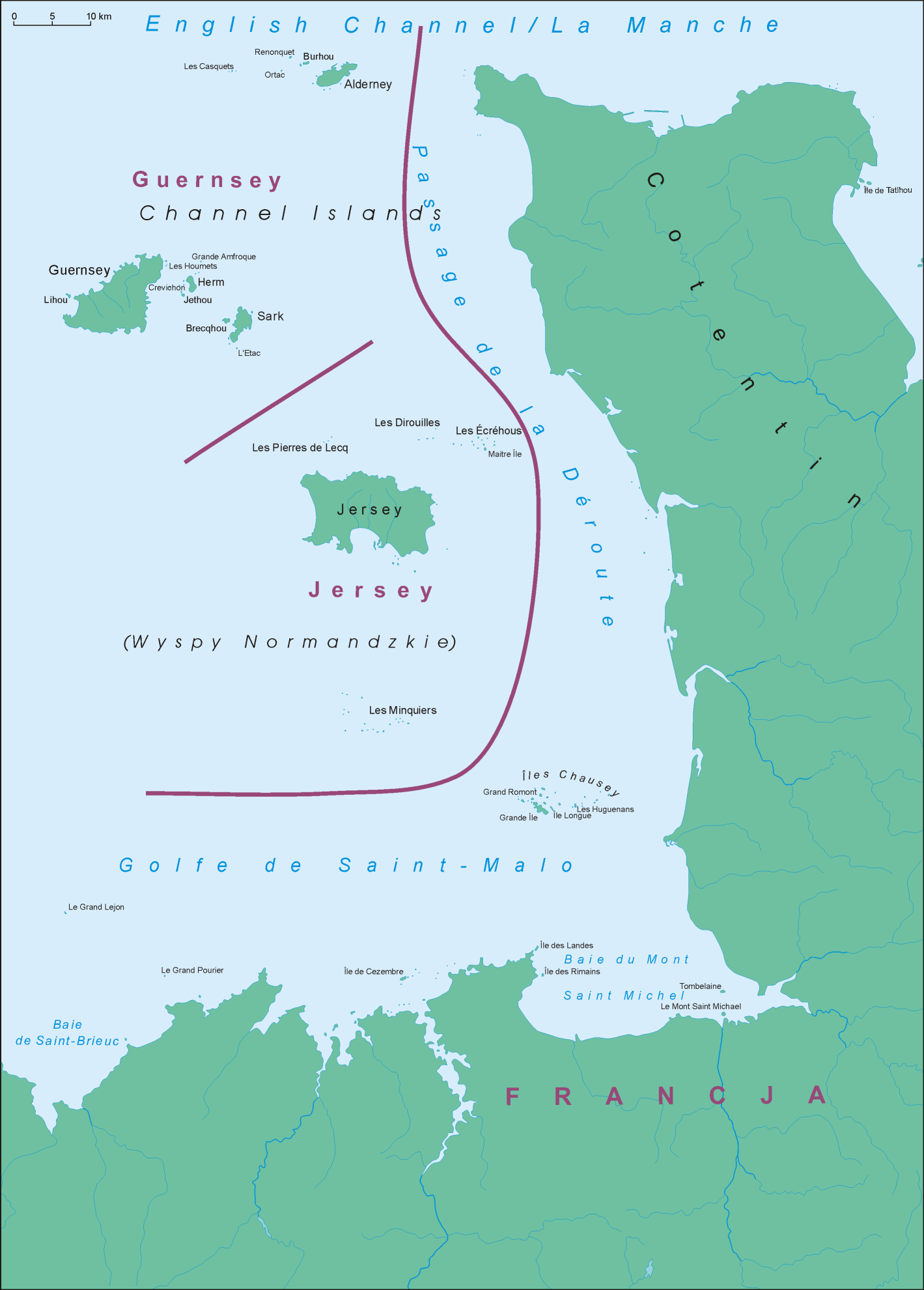
| Description |
Polski: Mapa Wysp Normandzkich English: Map of Channel Islands |
||||||||
| Date | |||||||||
| Source | Own work | ||||||||
| Author | Aotearoa | ||||||||
| Permission (Reusing this file) |
I, the copyright holder of this work, hereby publish it under the following license:
|

File history
Click on a date/time to view the file as it appeared at that time.
| Date/Time | Dimensions | User | Comment | |
|---|---|---|---|---|
| current | 00:00, 15 April 2008 | 1,419 × 1,980 (293 KB) | Aotearoa | == Summary == {{Information |Description=Location map of Sark |Source=własna praca |Date=14.04.2008 |Author= Aotearoa |Permission={{self|GFDL}} |other_versions= }} Category:Maps of the Channel Islands |
File usage
The following page uses this file: