Gelderland
Gelderland or Guelders is a province in the east of the Netherlands. The capital city is Arnhem, but Nijmegen and Apeldoorn are bigger. Other important cities are Zutphen, Doetinchem, Harderwijk and Tiel. About 2,097,000 people are living in Gelderland (2021).
|
Gelderland / Gelderlaand | |
|---|---|
Province | |
 | |
 Flag  Coat of arms | |
  Location | |
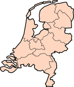
 Map | |
| Coordinates: 52°5′N 5°55′E / 52.083°N 5.917°E | |
| Country | Netherlands |
| Established | 1815 |
| Seat | Arnhem |
| Area | |
| • Total | 5,136 km2 (1,983 sq mi) |
| • Land | 4,964 km2 (1,917 sq mi) |
| • Water | 173 km2 (67 sq mi) |
| Highest elevation | 110 m (360 ft) |
| Lowest elevation | -1 m (−3.3 ft) |
| Population (2021) | |
| • Total | 2,097,000 |
| • Density | 422/km2 (1,090/sq mi) |
| Website | www |
It is surrounded by the provinces of Limburg, North Brabant, South Holland, Utrecht, Flevoland and Overijssel and the German federal state North Rhine-Westphalia.
The most important rivers are the Rhine (Rijn), the Waal, the IJssel and the Maas (border with North Brabant). The border with Flevoland is formed by the so-called randmeer ("border lake") of the Flevopolder.
History
In the 11th century, Guelders was a county. It was called Gelre in Dutch and Geldern in German. In 1339, it became a duchy. At first, it existed of the surroundings of the city of Geldern (now in Germany). By the end of the 14th century, it included most of the modern province of Gelderland and parts of the province of Limburg and of the German District of Cleves. It became part of the Habsburg Netherlands in 1543, one of the Seventeen Provinces.
Gelderland Media

- Daypanoramio

- Dodewaard()

.jpg)
Other websites
- Official website
- interactive province map Archived 2005-02-08 at the Wayback Machine
- another map, more up-to-date, but the map is not interactive Archived 2006-03-01 at the Wayback Machine
- Detailed map Archived 2006-02-10 at the Wayback Machine
Template:Achterhoek municipalities