Groningen (province)
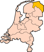
Groningen is a province in the Northeast of the Netherlands. At the east is the German region Lower Saxony, in the south is Drenthe, in the west is Friesland (or Fryslân in Frisian) and in the north is the Wadden Sea. About 596,000 people are living in Groningen (2023).
|
Groningen / Grunnen / Grönnen | |
|---|---|
Province | |
 | |
 Flag  Coat of arms | |
  Location | |
 Map | |
| Coordinates: 53°15′N 6°44′E / 53.250°N 6.733°E | |
| Country | Netherlands |
| Established | 1815 |
| Seat | Groningen |
| Area | |
| • Total | 2,955 km2 (1,141 sq mi) |
| • Land | 2,324 km2 (897 sq mi) |
| • Water | 632 km2 (244 sq mi) |
| Highest elevation | 14 m (46 ft) |
| Lowest elevation | -2 m (−6.6 ft) |
| Population (2023) | |
| • Total | 596,000 |
| • Density | 257/km2 (670/sq mi) |
| Website | www |
The capital of Groningen is also called Groningen. People from Groningen often call Groningen City "stad" ("city") and the rest of the province "Ommelanden" (which means something like "surrounding lands").
Important sources of income are agriculture and natural gas extraction Slochteren.
Noticeable things in Groningen are the Gronings dialect, which is related to Low Saxon, and the strong support for the communist party in the Northeastern part of the province.
Groningen (province) Media
Ogg: Grönnens Laid: Self made in own studio, is the official hymne of the people of Groningen, Netherlands.

1652 map of the city of Groningen and the surrounding fortifications

Canadian soldiers during the Battle of Groningen in April 1945

Satellite image of Groningen

The land is flat and 80% of it is used for agriculture

Wheat field near Nieuw-Beerta in the Oldambt

Mudflat hikers during low tide on the Wadden Sea near Pieterburen

The University Medical Center is a major employer in Groningen

Sea port of Delfzijl in 2012
A Gronings speaker, recorded in the Netherlands.
_-_Haubois,_1652.jpg)


Other websites
- Official website
- Flag
- Website of the Capital City
- Alternative Website of the Capital City (Local Shops and Small Businesses)
- Map of Groningen
- Website of the University
- Website of the Polytechnic
- Map of Province Archived 2005-02-08 at the Wayback Machine