Haute-Savoie
Haute-Savoie is a département in the Auvergne-Rhône-Alpes region of southeastern France, bordering Switzerland and Italy.
|
Haute-Savoie | |
|---|---|
 | |
 Flag  Coat of arms | |
 Location of Haute-Savoie in France | |
| Coordinates: 46°00′N 06°20′E / 46.000°N 6.333°ECoordinates: 46°00′N 06°20′E / 46.000°N 6.333°E | |
| Country | France |
| Region | Auvergne-Rhône-Alpes |
| Département | 1860 |
| Prefecture | Annecy |
| Subprefectures | Bonneville, Saint-Julien-en-Genevois, Thonon-les-Bains |
| Government | |
| • President | Christian Montei[1] |
| Area | |
| • Total | 4,387.8 km2 (1,694.1 sq mi) |
| Population (2014)[3] | |
| • Total | 783,127 |
| • Density | 178.4783/km2 (462.257/sq mi) |
| Time zone | UTC+1 (CET) |
| • Summer (DST) | UTC+2 (CEST) |
| ISO 3166 code | FR-74 |
| Arrondissements | 4 |
| Cantons | 17 |
| Communes | 281 |
| Website | www.hautesavoie.fr |
Name
Before 1860, the territory of the modern Haute-Savoie and Savoie departments had been part of the Kingdom of Sardinia, as a Duchy, since 1713. Annexation of the region by France was made in 1860. In that year, the Emperor Napoléon III divided the territory in two departments: Savoie, to the south, with the city of Chambéry, and Haute-Savoie, to the north, with the city of Annecy.
Haute ("High") in the name Haute-Savoie is not because of the altitude but because of its position, to the north, in the territory.
History
The department of Haute-Savoie was created in 1860 from the northern part of the Duchy of Sardinia with four arrondissements: Annecy, Bonneville, Saint-Julien and Thonon. The capital was Annecy.[4]
On 10 September 1926, the arrondissement of Saint-Julien was eliminated but became again an arrondissement in 1933.[4]
During World War II, the department was occupied by the fascist Italy, from November 1942 to September 1943.
Geography
The Haute-Savoie is part of the Auvergne-Rhône-Alpes region. It has an area of 4,387.8 km2 (1,694 sq mi).[2]
The department borders with the Ain and Savoie departments, both in the Auvergne-Rhône-Alpes region, and with Switzerland and Italy.
In the territory of the department is a part of the Mont Blder with Italy. The average altitude of the department is of about 1,160 m (3,810 ft). The highest point in the department is Mont Blanc (45°49′58″N 6°51′53″E / 45.83278°N 6.86472°E; it is 4,810 m (15,781 ft) high, the highest point of France, Italy and of Western Europe.[5]
The Haute-Savoie department is within the watershed of the Rhône river but with short rivers. There are two important lakes in the department: the Lake Geneva, shared with Switzerland, and the Lake Annecy.
Climate
The Köppen climate classification type for the climate at Annecy is an "Oceanic climate" (also known as Maritime Temperate climate) and of the subtype Cfb.[6]
Administration
Haute-Savoie is managed by the Departmental
of Haute-Savoie in Annecy. The department is part of the Auvergne-Rhône-Alpes region.
Administrative divisions
There are 4 arrondissements (districts), 17 cantons and 281 communes (municipalities) in Haute-Savoie.[7]
| INSEE code |
Arrondissement | Capital | Population[8] (2014) |
Area[9] (km²) |
Density (Inh./km²) |
Communes |
|---|---|---|---|---|---|---|
| 741 | Annecy | Annecy | 276,382 | 1,261.6 | 219.1 | 80 |
| 742 | Bonneville | Bonneville | 184,093 | 1,558.2 | 118.1 | 61 |
| 743 | Saint-Julien-en-Genevois | Saint-Julien-en-Genevois | 180,562 | 660.3 | 273.5 | 72 |
| 744 | Thonon-les-Bains | Thonon-les-Bains | 142,090 | 907.7 | 156.5 | 68 |
The following is a list of the 17 cantons of the Haute-Savoie department (with their INSEE codes), following the French canton reorganisation which came into effect in March 2015:[10]
- Annecy-1 (7401)
- Annecy-2 (7402)
- Annecy-le-Vieux (7403)
- Annemasse (7404)
- Bonneville (7405)
- Cluses (7406)
- Évian-les-Bains (7407)
- Faverges (7408)
- Gaillard (7409)
- Le Mont-Blanc (7410)
- La Roche-sur-Foron (7411)
- Rumilly (7412)
- Saint-Julien-en-Genevois (7413)
- Sallanches (7414)
- Sciez (7415)
- Seynod (7416)
- Thonon-les-Bains (7417)
Demographics
The inhabitants of Haute-Savoie are known, in French, as Haut-Savoyards (women: Haut-Savoyardes).[11]
Haute-Savoie had a population, in 2014, of 783,127,[3] for a population density of 178.5 inhabitants/km2. The arrondissement of Annecy, with 276,382 inhabitants, is the arrondissement with more inhabitants.[8]
Evolution of the population in Haute-Savoie

The communes in the department with more inhabitants are:
| City | Population (2014)[8] |
Arrondissement |
|---|---|---|
| Annecy | 53,285 | Annecy |
| Thonon-les-Bains | 34,973 | Thonon-les-Bains |
| Annemasse | 34,953 | Saint-Julien-en-Genevois |
| Seynod | 20,955 | Annecy |
| Annecy-le-Vieux | 20,469 | Annecy |
| Cluses | 17,510 | Bonneville |
| Cran-Gevrier | 17,257 | Annecy |
| Sallanches | 15,754 | Bonneville |
| Rumilly | 14,836 | Annecy |
| Saint-Julien-en-Genevois | 13,253 | Saint-Julien-en-Genevois |
Gallery

Annecy and Lake Annecy.

Bonneville castle.
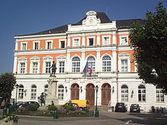
The city hall of Saint-Julien-en-Genevois.

Thonon-les-Bains - fishermen town.

Thonon-les-Bains and the Mont-Blanc.


Haute-Savoie Media

A monument to the Maquis des Glières in Entremont

Haute-Savoie highlighted in brown in the former Rhône-Alpes region, with arrondissements outlined

Map of Haute-Savoie.

Aerial view of Lake Annecy from the southeast

Reblochon is a French cow's-milk labelled Protected Designation of Origin (PDO) cheese, made in the Alps region of Haute-Savoie and Savoie.

Yvoire and the Lake Léman

Arve Valley and the town of Cluses

Chateau de Ruphy in Duingt


Related pages
References
- ↑ "Commission Permanente". Département de la Haute-Savoie. Retrieved 30 September 2017.
- ↑ 2.0 2.1 "Département de la Haute-Savoie (74)". Comparateur de territoire (in French). Institut national de la statistique et des études économiques - INSEE. Retrieved 30 September 2017.
{{cite web}}: CS1 maint: unrecognized language (link) - ↑ 3.0 3.1 "Populations légales 2014 des départements et des collectivités d'outre-mer" (in French). Institut national de la statistique et des études économiques - INSEE. Retrieved 30 September 2017.
{{cite web}}: CS1 maint: unrecognized language (link) - ↑ 4.0 4.1 "Historique de la Haute-Savoie". Le SPLAF (in French). Retrieved 30 September 2017.
{{cite web}}: CS1 maint: unrecognized language (link) - ↑ "Mont Blanc, France/Italy". Peakbagger.com. Retrieved 19 October 2016.
- ↑ "Ville de Annecy" (in French). Annuaire des Mairies et Villes de France. Retrieved 30 September 2017.
{{cite web}}: CS1 maint: unrecognized language (link) - ↑ "Département de la Haute-Savoie (74)" (in French). Institut national de la statistique et des études économiques - INSEE. Retrieved 30 September 2017.
{{cite web}}: CS1 maint: unrecognized language (link) - ↑ 8.0 8.1 8.2 "Régions, départements, arrondissements, cantons et communes" (PDF). Populations légales 2014 (in French). Institut national de la statistique et des études économiques - INSEE. Retrieved 30 September 2017.
{{cite web}}: CS1 maint: unrecognized language (link) - ↑ "Département de la Haute-Savoie (74)) et Arrondissements". Comparateur de territoire (in French). Institut national de la statistique et des études économiques - INSEE. Retrieved 30 September 2017.
{{cite web}}: CS1 maint: unrecognized language (link) - ↑ "Décret n° 2014-153 du 13 février 2014 portant délimitation des cantons dans le département de la Haute-Savoie" (in French). Légifrance.gouv.fr. Retrieved 30 September 2017.
{{cite web}}: CS1 maint: unrecognized language (link) - ↑ "Habitants du départment: Haute-Savoie" (in French). habitants.fr. Retrieved 30 September 2017.
{{cite web}}: CS1 maint: unrecognized language (link)
Other websites
- Departmental Council website (in French)
- Prefecture website (in French)