List of cities in the United Kingdom
This is a List of cities in the United Kingdom. This list includes all places with city status.
| City[1] | Year granted or confirmed |
Cathedral (pre-1889) | City council | Nation/Region | Image | Population |
|---|---|---|---|---|---|---|
| Aberdeen32 (Scots: Aiberdeen) (Scottish Gaelic: Obar Dheathain) |
St Machar's Cathedral | Local government district | Scotland (North East Scotland) | 
|
189,12038 | |
| Armagh11 (Irish: Ard Mhacha) (Ulster-Scots: Airmagh) |
1994 | not applicable | None. Represented on Armagh City, Banbridge and Craigavon Borough Council | Northern Ireland | 
|
59,340 (2011)[2] |
| Bangor1 | time immemorial | Cathedral Church of St Deiniol | Community | Wales | 
|
18,808 (2011)[3] |
| Bath1 | 1090 | Abbey Church of SS Peter & Paul4 | Charter trustees | South West, England | 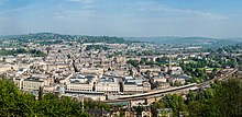
|
88,859 (2011)[4] 97,311 (urban area, 2010)[5] |
| Belfast (Irish: Béal Feirste) (Ulster-Scots: Bilfawst) |
1888 | not applicable | Local government district | Northern Ireland | 
|
333,871 (2011)[6] |
| Birmingham2 | 188933 | not applicable | Local government district (Metropolitan borough) |
West Midlands, England | 
|
1,092,330 (2013)[7] |
| Bradford1 | 1897 | not applicable | Local government district (Metropolitan borough) |
Yorkshire and the Humber, England | 
|
522,452 (2011)[8] |
| Brighton & Hove15 | 2000 | not applicable | Local government district (Unitary) |
South East, England | 
|
273,369 (2011)[8] |
| Bristol1 | 1542 | Cathedral Church of the Holy & Undivided Trinity | Local government district (Unitary and county) |
South West, England | 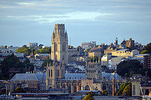
|
428,234 (2011)[8] |
| Cambridge3 | 195125 | not applicable | Local government district | East, England | 
|
123,867 (2011)[8] |
| Canterbury3 | time immemorial | Cathedral & Metropolitical Church of Christ |
Local government district (Non-metropolitan borough) |
South East, England | 
|
151,145 (2011)[8] |
| Cardiff9 (Welsh: Caerdydd) |
190529 | not applicable | Local government district | Wales | 
|
346,090 (2011)[8] |
| Carlisle1 | 1133 | Cathedral Church of the Holy & Undivided Trinity | Local government district | North West, England | 
|
107,524 (2011)[8] |
| Chelmsford37 | 2012 | not applicable | Local government district (Non-metropolitan borough) |
East, England | 
|
168,310 (2011)[8] |
| Chester3 | 1541 | Cathedral Church of Christ & the Blessed Virgin Mary | Charter trustees‡ | North West, England | 
|
91,733 (urban area, 2010)[5] |
| Chichester1 | 1075 | Cathedral Church of the Holy Trinity | Civil parish | South East, England | 
|
26,795 (2011)[9] |
| Colchester | 2022 | not applicable | Colchester Borough Council | East Anglia, England | 192,700[10] | |
| Coventry1 | 1102 | St Michael's Cathedral5 | Local government district (Metropolitan borough) |
West Midlands, England | 
|
316,915 (2011)[8] |
| Derby13 | 1977 | not applicable | Local government district (Unitary) |
East Midlands, England | 
|
248,752 (2011)[8] |
| Derry 39 (Irish: Doire) (Ulster-Scots: Derrie) |
1604[11] | not applicable | None. Represented on Derry City and Strabane District Council | Northern Ireland | 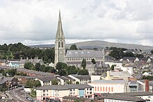
|
107,877 (2011)[2] |
| Dundee32 (Scottish Gaelic: Dùn Dèagh) |
188930 (Burgh: 1191) |
not applicable | Local government district | Scotland (North East Scotland) | 
|
153,99038 |
| Durham1 | time immemorial | Cathedral Church of Christ & St. Mary the Virgin | Charter trustees‡ | North East, England | 
|
94,375 (2011)[12] |
| Edinburgh32 (Scottish Gaelic: Dùn Èideann) |
18th century[13] (Burgh: 1329) |
not applicable | Local government district | Scotland (East Coast) | 
|
468,72038 |
| Ely1 | 1109 | Cathedral Church of the Holy & Undivided Trinity | Civil parish | East, England | 
|
20,256 (2011)[14] |
| Exeter1 | time immemorial | Cathedral Church of St Peter | Local government district | South West, England | 
|
117,773 (2011)[8] |
| Glasgow32 (Scots: Glesga) (Scottish Gaelic: Glaschu) |
18th century[13] (Burgh: 1492) |
Glasgow Cathedral (St Kentigern's or St Mungo's) | Local government district | Scotland (West Coast) | 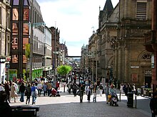
|
603,08038 |
| Gloucester1 | 1541 | Cathedral Church of St Peter & the Holy and Indivisible Trinity | Local government district | South West, England | 
|
121,688 (2011)[8] |
| Hereford119 | time immemorial | Cathedral Church of SS Mary the Virgin & Ethelbert the King | Civil parish | West Midlands, England | 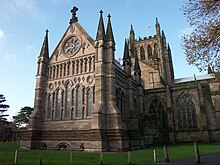
|
58,896 (2011)[15] |
| Inverness (Scottish Gaelic: Inbhir Nis) |
2000 | not applicable | none | Scotland (Highland Region) | 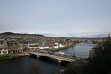
|
79,415[16] |
| Kingston upon Hull12 | 1897 | not applicable | Local government district (Unitary) |
Yorkshire and the Humber, England | 
|
256,406 (2011)[8] |
| Lancaster1 | 193726 | not applicable | Local government district | North West, England | 
|
138,375 (2011)[8] |
| Leeds1 | 1893 | not applicable | Local government district (Metropolitan borough) |
Yorkshire and the Humber, England | 
|
751,485 (2011)[8] |
| Leicester1 | 191922 | not applicable | Local government district (Unitary) |
East Midlands, England | 
|
329,839 (2011)[8] |
| Lichfield17 | time immemorial | Cathedral Church of SS Mary & Chad | Civil parish | West Midlands, England | 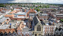
|
32,219 (2011)[17] |
| Lincoln3 | 1072 | Cathedral Church of St Mary | Local government district (Non-metropolitan borough) |
East Midlands, England | 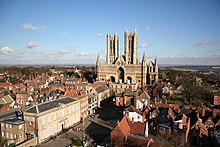
|
93,541 (2011)[8] |
| Lisburn (Irish: Lios na gCearrbhach) |
2002 | not applicable | None. Represented on Lisburn and Castlereagh City Council | Northern Ireland | 
|
120,165 (2011)[2] |
| Liverpool2 | 1880 | Cathedral Church of Christ | Local government district (Metropolitan borough) |
North West, England | 
|
466,415 (2011)[8] |
| London6 | time immemorial | St Paul's Cathedral | Local government district (sui generis and county) |
London | 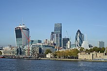
|
7,375 (2011)[8] |
| Manchester1 | 185334 | Manchester Cathedral | Local government district (Metropolitan borough) |
North West, England | 
|
503,127 (2011)[8] |
| Newcastle upon Tyne1 | 1882 | Cathedral Church of St Nicholas | Local government district (Metropolitan borough) |
North East, England | 
|
280,177 (2011)[8] |
| Newport14 (Welsh: Casnewydd) |
2002 | not applicable | Local government district | Wales | 
|
145,736 (2011)[8] |
| Newry (Irish: Iúr Cinn Trá) (Ulster-Scots: Newrie) |
2002 | not applicable | None. Represented on Newry, Mourne and Down District Council | Northern Ireland | 
|
29,946 (2008, settlement population)[18] |
| Norwich1 | 1094 | Cathedral Church of the Holy & Undivided Trinity | Local government district | East, England | 
|
132,512 (2011)[8] |
| Nottingham1 | 1897 | not applicable | Local government district (Unitary) |
East Midlands, England | 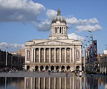
|
305,680 (2011)[8] |
| Oxford1 | 1542 | Cathedral Church of Christ | Local government district | South East, England | 
|
151,906 (2011)[8] |
| Perth (Scots: Pairth) (Scottish Gaelic: Peairt) |
2012[19] (Burgh: 12th century)[21] |
not applicable | none | Scotland (Central Belt) | 45,77038 | |
| Peterborough2 | 1541 | Cathedral Church of St Peter, St Paul, & St Andrew |
Local government district (Unitary) |
East, England | 
|
183,631 (2011)[8] |
| Plymouth1 | 192827 | not applicable | Local government district (Unitary) |
South West, England | 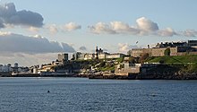
|
256,384 (2011)[8] |
| Portsmouth1 | 192624 | not applicable | Local government district (Unitary) |
South East, England | 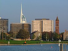
|
205,056 (2011)[8] |
| Preston14 | 2002 | not applicable | Local government district | North West, England | 
|
140,202 (2011)[8] |
| Ripon1 | 1836 | Cathedral Church of SS Peter & Wilfrid | Civil parish | Yorkshire and the Humber, England | 
|
16,702 (2011)[22] |
| St Albans7 | 187736 | Cathedral & Abbey Church of St Alban | Local government district (Non-metropolitan borough) |
East, England | 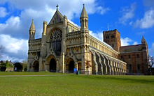
|
140,644 (2011)[8] |
| St Asaph37 (Welsh: Llanelwy) |
2012 | not applicable | Community | Wales | 
|
3,355 (2011)[23] |
| St Davids20 (Welsh: Tyddewi) |
1994 | not applicable | Community | Wales | 
|
1,841 (2011)[24] |
| Salford1 | 192624 | not applicable | Local government district (Metropolitan borough) |
North West, England | 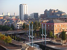
|
233,933 (2011)[8] |
| Salisbury35 | 1227 | Cathedral Church of St Mary | Civil parish‡ | South West, England | 
|
40,302 (2011)[25] |
| Sheffield3 | 1893 | not applicable | Local government district (Metropolitan borough) |
Yorkshire and the Humber, England | 
|
552,698 (2011)[8] |
| Southampton1 | 1964 | not applicable | Local government district (Unitary) |
South East, England | 
|
236,882 (2011)[8] |
| Stirling (Scots: Stirlin) (Scottish Gaelic: Sruighlea) |
2002 | not applicable | none | Scotland (Central Belt) | 
|
34,79038 |
| Stoke-on-Trent3 | 192528 | not applicable | Local government district (Unitary) |
West Midlands, England | 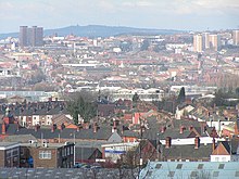
|
249,008 (2011)[8] |
| Sunderland18 | 1992 | not applicable | Local government district (Metropolitan borough) |
North East, England | 
|
275,506 (2011)[8] |
| Swansea9 (Welsh: Abertawe) |
196923 | not applicable | Local government district | Wales | 
|
239,023 (2011)[8] |
| Truro1 (Cornish: Truru) |
1877 | Cathedral Church of St Mary | Civil parish | South West, England | 
|
18,766 (2011)[26] |
| Wakefield3 | 1888 | Cathedral Church of All Saints | Local government district (Metropolitan borough) |
Yorkshire and the Humber, England | 
|
325,837 (2011)[8] |
| Wells1 | time immemorial | Cathedral Church of St Andrew | Civil parish | South West, England | 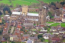
|
10,536 (2011)[27] |
| Westminster21 | 1540 | Westminster Abbey4 (Though, this was only a cathedral for 10 years until 1550 the city did not lose its status) | Local government district (London borough) |
London |  , ,
|
219,396 (2011)[8] |
| Winchester1 | time immemorial | Cathedral Church of the Holy Trinity | Local government district (Non-metropolitan borough) |
South East, England | 
|
116,595 (2011)[8] |
| Wolverhampton16 | 2000 | not applicable | Local government district (Metropolitan borough) |
West Midlands, England | 
|
249,470 (2011)[8] |
| Worcester3 | time immemorial | Cathedral Church of Christ & St Mary | Local government district | West Midlands, England | 
|
98,768 (2011)[8] |
| York18 | time immemorial | Cathedral & Metropolitical Church of St Peter | Local government district (Unitary) |
Yorkshire and the Humber, England | 
|
198,051 (2011)[8] |
<section end=pregrouptable />
References
- ↑ Department for Culture, Media and Sport. "Civic Honours Competition: UK Cities". The National Archives (United Kingdom), January 18, 2011. Accessed December 17, 2018.
- ↑ 2.0 2.1 2.2 "Usual Resident Population: KS101NI (administrative geographies)". Census 2011. Northern Ireland Statistics and Research Agency. Archived from the original on December 26, 2018. Retrieved October 4, 2013.
- ↑ Office for National Statistics Archived 2015-04-02 at the Wayback Machine 2011 census - Bangor C
- ↑ "Bath". BANES 2011 Census Ward Profiles. Retrieved March 13, 2015. (Combined populations of the 16 wards that make-up the city.)
- ↑ 5.0 5.1 "Mid 2010 Urban Area Estimates England and Wales". Office for National Statistics. September 4, 2012. Retrieved April 7, 2014.
- ↑ "Usual Resident Population: KS101NI (administrative geographies)". Census 2011. Northern Ireland Statistics and Research Agency. Archived from the original on June 15, 2015. Retrieved June 13, 2015.
- ↑ "UK Population Estimates" Archived 2014-08-10 at the Wayback Machine. (ONS). Retrieved June 28, 2014
- ↑ 8.00 8.01 8.02 8.03 8.04 8.05 8.06 8.07 8.08 8.09 8.10 8.11 8.12 8.13 8.14 8.15 8.16 8.17 8.18 8.19 8.20 8.21 8.22 8.23 8.24 8.25 8.26 8.27 8.28 8.29 8.30 8.31 8.32 8.33 8.34 8.35 8.36 8.37 8.38 8.39 8.40 8.41 "2011 Census: KS101EW Usual resident population, local authorities in England and Wales". Office for National Statistics. Retrieved January 8, 2013.
- ↑ Office for National Statistics Archived 2015-04-02 at the Wayback Machine 2011 census - Chichester CP
- ↑ "Colchester City Council". www.colchester.gov.uk. Retrieved November 24, 2023.
- ↑ City commemorates the 400th Anniversary of the City’s first charter, Derry City Council press release dated 7 July 2004, (accessed 15 December 2007) Archived June 2, 2008, at the Wayback Machine
- ↑ City status extends to the area of the former District of Durham "Charter trust and Mayor for Durham City". Durham County Council. Archived from the original on January 6, 2014. Retrieved September 19, 2022. "2011 Census Statistical Profile". Durham County Council. Retrieved February 2, 2013.[dead link]
- ↑ 13.0 13.1 13.2 Beckett, J.V. (2005). City Status in the British Isles, 1830-2002. Ashgate. p. 16. ISBN 978-0-7546-5067-6.
- ↑ Office for National Statistics Archived 2016-01-08 at the Wayback Machine 2011 census - Ely (Cambs) CP
- ↑ "2011 Census: Usual resident population estimates by broad age group for Wards & Market Towns in Herefordshire". Herefordshire Council. Retrieved January 8, 2013.[dead link]
- ↑ "Highland Profile". Highland Council.
- ↑ Office for National Statistics Archived 2017-04-22 at the Wayback Machine 2011 census - Lichfield CP
- ↑ "Home".
- ↑ Letters Patent dated May 21, 2012 "News: The National Records of Scotland seals Perth's city status". National Archives of Scotland. July 6, 2012. Archived from the original on July 17, 2012. Retrieved January 27, 2019. 'We really feel part of history being made' — Letters Patent makes Perth's city status official. July 5, 2012. http://www.thecourier.co.uk/News/Perthshire/article/23713/we-really-feel-part-of-history-being-made-letters-patent-makes-perth-s-city-status-official.html. Retrieved September 19, 2022.
- ↑ A A M Duncan (March 24, 1973). "Perth. The First Century of the Burgh" (PDF). Transactions of the Perthshire Society of Natural Science. Archived from the original (PDF) on December 26, 2018. Retrieved September 19, 2022.
- ↑ Created a royal burgh at some point under King David I (1124–53) although the earliest surviving charters date to 1209 or 1210; the status was abolished in 1975.[13][20]
- ↑ Office for National Statistics Archived 2016-03-14 at the Wayback Machine 2011 census - Ripon CP
- ↑ Office for National Statistics Archived 2015-05-09 at the Wayback Machine 2011 census - St. Asaph C
- ↑ Office for National Statistics Archived 2015-04-02 at the Wayback Machine 2011 census - St. David's and the Cathedral Close C
- ↑ Office for National Statistics Archived 2016-03-04 at the Wayback Machine 2011 census - Salisbury CP
- ↑ Office for National Statistics 2011 census - Truro CP
- ↑ "Wells CP - Usual Resident Population, 2011". Neighbourhood Statistics. Office for National Statistics. Retrieved December 24, 2014.