New London County, Connecticut
New London County is a county in the southeastern corner of the U.S. state of Connecticut. As of 2020, the population was 268,555.[1] The total area of the county is 772 square miles (2,000 km2).
| New London County, Connecticut | |
| Map | |
 Location in the state of Connecticut | |
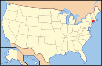
 Connecticut's location in the U.S. | |
| Statistics | |
| Founded | 1646 by John Winthrop, Jr. |
|---|---|
| Seat | none (since 1960) New London, Connecticut (before 1960) |
| Largest City | Norwich |
| Area - Total - Land - Water |
772 sq mi (1,999 km²) 665 sq mi (1,722 km²) 107 sq mi (277 km²), 13.8% |
| Population - (2020) - Density |
268,555 403.8/sq mi (156/km²) |
| Time zone | Eastern: UTC-5/-4 |
| Named for: London, England | |
The same as all eight of Connecticut's counties, there is no county government and no county seat. In Connecticut, towns are responsible for all local government activities, including fire and rescue, snow removal and schools. In a few cases, neighboring towns will share some resources (e.g., water, gas, etc.). New London County is only a group of towns on a map. It has no governmental authority.
New London County was one of four original counties in Connecticut. They were formed May 10, 1666.
Border counties
- Windham County (north)
- Kent County, Rhode Island (northeast)
- Washington County, Rhode Island (east)
- Tolland County (northwest)
- Hartford County (northwest)
- Suffolk County, New York (south) Water boundary only, with ferry access to Fishers Island
Towns
- Bozrah
- Colchester
- East Lyme
- Franklin
- Griswold
- Borough of Jewett City
- Hopeville
- Glasgo
- Pachaug
- Groton
- City of Groton
- Groton Long Point
- Long Hill
- Mystic (also in Stonington)
- Noank
- Poquonock Bridge
- Lebanon
- Ledyard
- Gales Ferry
- Ledyard Center
- Lisbon
- Lyme
- Montville
- Chestefield
- Mohegan
- Oakdale
- Oxoboxo River (census-designated place)
- Uncasville
- New London
- North Stonington
- Norwich
- Old Lyme
- Preston
- Poquetanuck
- Preston City
- Salem
- Sprague
- Baltic
- Stonington
- Pawcatuck
- Mystic (also in Groton)
- Old Mystic
- Voluntown
- Waterford
- Quaker Hill
New London County, Connecticut Media
Map of New London County, Connecticut showing cities, boroughs, towns, CDPs, and Indian Reservations
References
- ↑ "Census - Geography Profile: New London County, Connecticut". United States Census Bureau. Retrieved November 20, 2021.