Oregon
Oregon is a state in the United States. Salem is the capital (where most of the state government works), and Portland is the city with the most people. Oregon was the 33rd state to join the United States, in 1859.
| State of Oregon | |
|
| |
|
| |
| Anthem: Oregon, My Oregon | |
 Map of the United States with Oregon highlighted | |
| Country | United States |
| Before statehood | Oregon Territory |
| Admitted to the Union | February 14, 1859 (33rd) |
| Capital | Salem |
| Largest city | Portland |
| Largest metro | Portland metropolitan area |
| Government | |
| • Governor | Tina Kotek (D) |
| • Secretary of State | Shemia Fagan (D) |
| Legislature | Legislative Assembly |
| • Upper house | State Senate |
| • Lower house | House of Representatives |
| U.S. senators | Ron Wyden (D) Jeff Merkley (D) |
| U.S. House delegation | 4 Democrats 1 Republican (list) |
| Area | |
| • Total | 98,381 sq mi (254,806 km2) |
| • Land | 95,997 sq mi (248,849 km2) |
| • Water | 2,384 sq mi (6,177 km2) 2.4% |
| • Rank | 9th |
| Elevation | 3,300 ft (1,000 m) |
| Highest elevation | 11,249 ft (3,428.8 m) |
| Lowest elevation (Pacific Ocean[2]) | 0 ft (0 m) |
| Population (2019) | |
| • Total | 4,217,737 |
| • Rank | 27th |
| • Density | 39.9/sq mi (15.0/km2) |
| • Rank | 39th |
| • Median household income | $60,212[4] |
| • Income rank | 21st |
| Language | |
| • Official language | De jure: none[5] De facto: Pacific Northwest English |
| Time zones | |
| primary | UTC−08:00 (Pacific) |
| • Summer (DST) | UTC−07:00 (PDT) |
| primary for Malheur County | UTC−07:00 (Mountain) |
| • Summer (DST) | UTC−06:00 (MDT) |
| USPS abbreviation | OR |
| ISO 3166 code | US-OR |
| Trad. abbreviation | Ore. |
| Latitude | 42° N to 46°18′ N |
| Longitude | 116°28′ W to 124°38′ W |
| Website | www |
| Oregon state symbols | |
|---|---|
 | |
 | |
| Living insignia | |
| Bird | Western meadowlark (Sturnella neglecta) |
| Crustacean | Dungeness crab (Metacarcinus magister) |
| Fish | Chinook salmon (Oncorhynchus tshawytscha) |
| Flower | Oregon grape (Mahonia aquifolium) |
| Grass | Bluebunch wheatgrass (Pseudoroegneria spicata) |
| Insect | Oregon swallowtail (Papilio oregonius) |
| Mammal | American beaver (Castor canadensis) |
| Tree | Douglas-fir |
| Inanimate insignia | |
| Beverage | Milk |
| Dance | Square dance |
| Food | Pear (Pyrus) |
| Fossil | Metasequoia |
| Gemstone | Oregon sunstone |
| Motto | She Flies With Her Own Wings [6] |
| Rock | Thunderegg |
| Shell | Oregon hairy triton (Fusitriton oregonensis) |
| Soil | Jory soil |
| Other | Nut: Hazelnut |
| State route marker | |
 | |
| State quarter | |
 Released in 2005 | |
| Lists of United States state symbols | |
Geography
The state of Washington is to the north of Oregon. California and Nevada are to the south. Idaho is to the east. The Pacific Ocean is to the west.
The Columbia River flows along most of the border with Washington. The Snake River flows along much of the border with Idaho. The highest mountain is Mount Hood (11,237 feet or 3,425 m high), part of the Cascade Range of mountains. Another famous Cascade Mountain in Oregon is Mount Mazama, better known as Crater Lake.
History
Oregon was a long way from the United States of America, which was east of the Mississippi river in the 1830s and 1840s. To get to Oregon, settlers had to cross the Great Plains, which were empty except for a few forts and groups of Native Americans. Most people thought that it was impossible to farm there. They called it the "Great American Desert", because crossing it was long and dangerous; however, thousands did anyway.[7]
Mountain men (people who knew a lot about living in mountainous places) had found a passway over the Rocky Mountains, and they named it the South Pass. This path helped many wagons to reach the west coast. In 1836 a missionary named Marcus Whitman crossed through the pass with his wife to Oregon. This proved that it was possible for others with women and families to go too, and because of this, Oregon suddenly became the place pioneers wanted to make a trip to.
Most of the settlers that came by the Oregon Trail had a very difficult trip. The Trail began in Missouri, and they went in covered wagons pulled by animals like bulls. They could only travel 100 miles in one week, and so the whole trip would take half a year.[7] But still, lots of pioneers traveled so much that it is still possible to see the wagon ruts in some places today.
Life on the trail was very hard for the pioneers.[7] Every day, they would break up and camp, travel all day, and set up camp again. Food was usually beans and coffee, for every single day of the trip. The travelers always searched for water, wood for fires, and something to catch and eat fresh. But these were hard to find, and so sometimes they got mad at each other and fought with fists and guns.
The Trail was also dangerous. Rivers could flood, washing away people and other things. Native Americans could attack, oxen or horses could die, and diseases and injuries could strike.
By 1840, due to all the hard work of the pioneers, there were thousands of Americans in Oregon. Towns and farms had been set up. The area was part of British North America at the time. But the British, however, only had a few hundred settlers in Oregon. Because of this, the Americans began to plan to take over the whole land.[7]
Many Americans wanted this as well. They made up the slogan, "Fifty-four Forty or Fight!" and wanted all of Oregon up to latitude 54 or they would go to war with Britain to get it. They were so eager to have Oregon all for themselves, they supported James Polk as president because he claimed to have similar thoughts with them as well.[7]
However, after President Polk was elected, he began to be more sensible. He did not want to wage war with Britain, if it could be avoided. The British also realized that the Americans would soon have enough settlers in Oregon to easily drive out the British defenders. In 1846 the British offered to divide Oregon by giving most of the border land between the USA and what is now Canada.[7] President Polk accepted this, and so now the Americans had power over Oregon as well as the other states.
Education
There are a number of colleges and universities in Oregon. The four-year universities with the most students are Portland State University, Oregon State University, and the University of Oregon.
Oregon Media

2014-07-06 14 49 35 View north along Harney County Route 201 (Fields-Denio Road) at the end of Nevada State Route 292 (Denio Road) at the Oregon border in Denio, Nevada
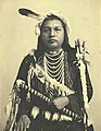
Paul Shoaway, Umatilla Indian, in ceremonial dress, Washington (4951753872)

Monument near Coos Bay, Oregon, of Francis Drake's first North American Encounter. Plaque by Oregon State Parks and Oregon Historical Society.

Fort Astoria, as established by John Jacob Astor in 1813

Crater Lake

Mount Hood is the highest peak in Oregon.
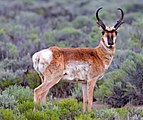
Antilocapra americana (Pronghorn antelope)

Köppen climate types in Oregon

Graph of Oregon's population growth from 1850 to 2010

Packed circles diagram showing estimates of the ethnic origins of people in Oregon in 2021.
_at_the_end_of_Nevada_State_Route_292_(Denio_Road)_at_the_Oregon_border_in_Denio,_Nevada.JPG)
.jpg)


.jpg)


Related pages
References
- ↑ "Mount Hood Highest Point". NGS data sheet. U.S. National Geodetic Survey. http://www.ngs.noaa.gov/cgi-bin/ds_mark.prl?PidBox=RC2244. Retrieved October 24, 2011.
- ↑ 2.0 2.1 "Elevations and Distances in the United States". United States Geological Survey. 2001. Archived from the original on October 15, 2011. Retrieved October 24, 2011.
- ↑ Elevation adjusted to North American Vertical Datum of 1988.
- ↑ "Median Annual Household Income". The Henry J. Kaiser Foundation. Archived from the original on December 20, 2016. Retrieved December 9, 2016.
- ↑ Hall, Calvin (January 30, 2007). English as Oregon's official language? It could happen. http://dailyemerald.com/2007/01/30/english-as-oregons-official-language-it-could-happen/. Retrieved May 8, 2007.
- ↑ "Oregon Focus: State Symbols: Motto". Oregon Secretary of State. Retrieved 27 May 2020.
- ↑ 7.0 7.1 7.2 7.3 7.4 7.5 Buskey, Theresa K. (March 2001). History and Geography LIFEPAC. Alpha Omega. pp. 17/18. ISBN 978-1-58095-155-5.