Saarbrücken
- The title of this article contains the character ü. Where it is unavailable or not wanted, the name may be written as Saarbruecken.
 | |
.png) Flag  Coat of arms | |
Location of Saarbrücken within Saarbrücken district | |
| Coordinates: 49°14′N 7°0′E / 49.233°N 7.000°ECoordinates: 49°14′N 7°0′E / 49.233°N 7.000°E | |
| Country | Germany |
| State | Saarland |
| District | Saarbrücken |
| Subdivisions | 20 |
| Government | |
| • Mayor | Charlotte Britz (SPD) |
| Area | |
| • Town | 167.07 km2 (64.51 sq mi) |
| Elevation | 230.1 m (754.9 ft) |
| Population (2017-06-30) | |
| • Town | 180,623 |
| • Density | 1,081.12/km2 (2,800.09/sq mi) |
| • Urban | 329,593 [2] |
| • Metro | 700,000[1] |
| Time zone | UTC+01:00 (CET) |
| • Summer (DST) | UTC+02:00 (CEST) |
| Postal codes | 66001–66133 |
| Vehicle registration | SB |
| Website | www |
County of Saarbrücken | |||||||||
|---|---|---|---|---|---|---|---|---|---|
| 12th century–1797 | |||||||||
| Status | State of the Holy Roman Empire | ||||||||
| Capital | Saarbrücken | ||||||||
| Common languages | Rhine Franconian; see language of the Saarland | ||||||||
| Government | Principality | ||||||||
| Historical era | Middle Ages | ||||||||
• Joined Holy Roman Empire | 925 | ||||||||
• | ca 1120 12th century | ||||||||
• Passed to Nassau-Weilburg | 1353 | ||||||||
• Occupied by France | 1793 | ||||||||
• | 1797 | ||||||||
| June 9 1815 | |||||||||
| |||||||||
Saarbrücken (German: [zaːɐ̯ˈbʁʏkn̩] (![]() listen); French: Sarrebruck[3] [saʁbʁyk]; Rhine Franconian: Saarbrigge [zaːˈbʁɪɡə]; Latin: Saravipons) is a German city and a district in the state of Saarland.
listen); French: Sarrebruck[3] [saʁbʁyk]; Rhine Franconian: Saarbrigge [zaːˈbʁɪɡə]; Latin: Saravipons) is a German city and a district in the state of Saarland.
The city is also the capital of the Saarland. Saarbrücken has 180,000 inhabitants. It is on the Saar River.
Saarbrücken Media

Ruins of the Roman camp Römerkastell

The Mithras shrine at Halberg hill

The Ludwigskirche (Ludwig Church)

Lulustein in 1871, commemorating Prince Louis Bonaparte's first cannon shot
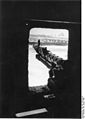
Machine-gun emplacement of a bunker. Saarbrücken, 1940.

M24, donated by veterans of the 70th US Infantry, facing ruins of fortifications at Spicheren Heights

Saarkran, reconstructed next to William-Henry-Bridge in 1991

Results of the second round of the 2019 mayoral election.

Winning party by precinct in the 2019 city council election.

- LudwigsparkstadionSaarbrücken


_b_753.jpg)


.svg)


References
- ↑ Eurodistrict SaarMoselle
- ↑ [1] Archived 2018-06-19 at the Wayback Machine Saarland.de – Amtliche Einwohnerzahlen Stand 30.06.2017
- ↑ "Start | Landeshauptstadt Saarbrücken". Saarbruecken.de (in français and Deutsch).
Other websites
![]() Media related to Saarbrücken at Wikimedia Commons
Media related to Saarbrücken at Wikimedia Commons