Gulf of California
The Gulf of California (also called Sea of Cortez or Sea of Cortés; and nearby is known in the Spanish language as Mar de Cortés or Mar Bermejo or Golfo de California) is an area of water that is in between the Baja California Peninsula and Mexican mainland. It is surrounded by the states of Baja California, Baja California Sur, Sonora, and Sinaloa. The name "Gulf of California" is on most maps in English today. The name "Sea of Cortés" is the one preferred by local people. Francisco de Ulloa named it for Hernán Cortés, who sent him to explore the coast.
The Gulf was made 5.3 million years ago, changing the flow of the Colorado River. Other rivers which also flow into the Gulf of California are the Fuerte, Mayo, Sinaloa, Sonora, and the Yaqui. Its area is about 160,000 km² (62,000 square miles).
Geology
The Gulf of California was made as parts of the planets surface moved the Baja California Peninsula off of the North American Plate. As part of this process, the East Pacific Rise formed along the middle of the Gulf along the bottom of the sea. The Gulf would go as far as Indio, California if there wasn't a large river delta made by the Colorado River. This delta blocks the sea from flooding the Mexicali and Imperial Valleys. Volcanoes can be found along the East Pacific Rise. The island of Isla Tortuga is one example of the volcanoes found.[1]
Islands
The Gulf of California has two large islands, the Isla Ángel de la Guarda and Tiburón Island. It also has several smaller ones, including Isla Espiritu Santo and Isla Partida which is joined to it by a small bit of land.
Gulf Of California Media

Satellite picture of the gulf
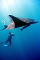
Giant Pacific manta ray


References
- ↑ "Science Plans RCL". review.nsf-margins.org. Archived from the original on 2009-02-18. Retrieved 2008-05-27.