St. Lucie County, Florida
St. Lucie County is a county in the state of Florida. The county seat is the city of Fort Pierce. As of 2020, 329,226 people lived there.[1]
| St. Lucie County, Florida | |

| |
| Map | |
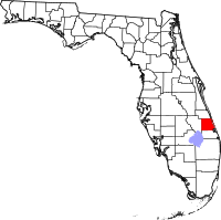
 Location in the state of Florida | |
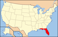
 Florida's location in the U.S. | |
| Statistics | |
| Founded | May 24, 1905 |
|---|---|
| Seat | Fort Pierce |
| Largest City | Port St. Lucie |
| Area - Total - Land - Water |
688 sq mi (1,782 km²) 572 sq mi (1,481 km²) 116 sq mi (300 km²), 16.9% |
| Population - (2020) - Density |
329,226 576/sq mi (222/km²) |
| Time zone | Eastern: UTC-5/-4 |
| Website: www.stlucieco.gov/ | |
| Named for: St. Lucie Inlet | |
History
The current St. Lucie County was created in 1905 from the southern part of Brevard County. Brevard County had been named St. Lucie County from 1844 until 1855 when it was renamed Brevard County.
In 1925, Indian River County was created out of the northern part of St Lucie County, while northern Martin County was created from a small part of southeastern St. Lucie County and the northern part of Palm Beach County. Much of western St Lucie County had gone in 1917 to form Okeechobee County.
Land
According to the 2000 census, the county has a total area of 688.08 square miles (1,782.1 km2), of which 572.45 square miles (1,482.6 km2) (or 83.20%) is land and 115.63 square miles (299.5 km2) (or 16.80%) is water,[2] much of it in the Atlantic Ocean.
St. Lucie County is part of the Port St. Lucie Metropolitan Statistical Area.
Major highways
Counties nearby
- Indian River County, Florida - north
- Martin County, Florida - south
- Okeechobee County, Florida - west
People
As of the census[3] of 2000, there were 192,695 people, 76,933 households, and 54,237 families living in the county. The population density was 337 people per square mile (130/km²). There were 91,262 housing units at an average density of 159 per square mile (62/km²). The racial makeup of the county was 79.14% White, 15.42% African American, 0.24% Native American, 0.95% Asian, 0.05% Pacific Islander, 2.37% from other races, and 1.82% from two or more races. Hispanic or Latino of any race were 8.16% of the population. 86.6% spoke English, 7.6% Spanish, 1.6% French Creole and 1.0% French as their first language. 3.3% of the population identified themselves as being of non-Hispanic West Indian Ancestry.[3]
In 2005 St. Lucie county had a population that was 69.2% non-Hispanic white, 16.5% African-American, 12.4% Latino and 1.3% Asian.[4]
In 2000 there were 76,933 households out of which 26.30% had children under the age of 18 living with them, 55.30% were married couples living together, 11.10% had a female householder with no husband present, and 29.50% were not related. 23.50% of all households were made up of people living alone and 12.40% had someone living alone who was 65 years of age or older. The average household size was 2.47 and the average family size was 2.89.
In the county the population was spread out with 22.60% under the age of 18, 6.60% from 18 to 24, 25.10% from 25 to 44, 23.00% from 45 to 64, and 22.70% who were 65 years of age or older. The median age was 42 years. For every 100 females there were 95.50 males. For every 100 females age 18 and over, there were 92.80 males.
The median income for a household in the county was $36,363, and the median income for a family was $41,381. Males had a median income of $30,047 versus $22,684 for females. The per capita income for the county was $18,790. About 9.60% of families and 13.40% of the population were below the poverty line, including 20.50% of those under age 18 and 7.70% of those age 65 or over.
Cities and towns
Incorporated
- City of Fort Pierce
- City of Port St. Lucie
- Village of St. Lucie
Unincorporated
Education
Schools in the county are managed by St. Lucie County Public Schools.
- Florida Atlantic University PSL Campus
- Indian River State College Ft. Pierce and PSL Campus
- Keiser University PSL Campus
- University of Florida Institute of Food and Agricultural Sciences, Ft. Pierce
- Barry University PSL Campus
Points of interest
- St. Lucie County Regional History Center
- St. Lucie County Marine Center Archived 2013-08-09 at the Wayback Machine
- Experimental Oculina Research Reserve
- Heathcote Botanical Gardens
- Old Fort Park
- St. Lucie County International Airport
- US Navy UDT-SEAL Museum (Fort Pierce was the original home of the Navy SEALs)
St. Lucie County, Florida Media
References
- ↑ "QuickFacts: St. Lucie County, Florida". United States Census Bureau. Retrieved August 23, 2023.
- ↑ "Census 2000 U.S. Gazetteer Files: Counties". United States Census. Retrieved 2011-02-13.
- ↑ 3.0 3.1 "American FactFinder". United States Census Bureau. Retrieved 2008-01-31.
- ↑ "State & County QuickFacts". U.S. Census Bureau. Archived from the original on 2011-07-20. Retrieved 2009-02-18.
Other websites
Governmental
Board of County Commissioners
Constitutional officers
School district
Multi-county districts
Judicial branch
Non-governmental
- St. Lucie County Tourism Web Site Archived 2007-09-28 at the Wayback Machine