Wabaunsee County, Kansas
Wabaunsee County (standard abbreviation: WB) is a county in the U.S. state of Kansas. In 2010, 7,053 people lived there.[1] Its county seat is Alma.[2] The county was created by the territorial legislature of Kansas Territory on March 25, 1859.[3] It was named after a chief of the Potawatomi Indians.[3]
| Wabaunsee County, Kansas | |
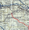
| Map | |
 Location in the state of Kansas | |
 Kansas's location in the U.S. | |
| Statistics | |
| Founded | 1859 |
|---|---|
| Seat | Alma |
| Largest City | Alma |
| Area - Total - Land - Water |
800 sq mi (2,072 km²) 794 sq mi (2,056 km²) 5.3 sq mi (14 km²), 0.7% |
| PopulationEst. - (2016) - Density |
6,891 8.7/sq mi (3/km²) |
| Time zone | Central: UTC-6/-5 |
| Named for: Chief Waubonsie | |
History
19th century
The first white people in the area were said to have been a group of criminals. This group was known as the McDaniel Gang.[3]
Wabaunsee County was created by the territorial legislature on March 25, 1859.[3] The name used since 1859 is from the Potawatomi "Wah-bon-seh". This means "dawn of day." It was the name of the chief of the Potawatomi Indians.[3] Originally, the county was named Richardson. This was named after William Alexander Richardson, a congressman from Illinois, who introduced the first Kansas and Nebraska Bill in the United States House of Representatives. This made certain Indian lands territories in 1854.[4]
The county's first church, Wabaunsee Church of Christ, was created in June 1857.[3]
The first railroad to be built through Wabaunsee County was the Atchison, Topeka, and Santa Fe in 1880.[5] In 1887, the Chicago, Kansas and Nebraska Railway built a railroad from Topeka to Herington.[6] This railroad connected Topeka, Valencia, Willard, Maple Hill, Vera, Paxico, McFarland, Alma, Volland, Alta Vista, Dwight, White City, Latimer, Herington.
Geography
The U.S. Census Bureau says that the county has a total area of 800 square miles (2,100 km2). Of that, 794 square miles (2,060 km2) is land and 5.3 square miles (14 km2) (0.7%) is water.[7]
People
| Historical populations | |||
|---|---|---|---|
| Census | Pop. | %± | |
| 1860 | 1,023 | ||
| 1870 | 3,362 | 228.6% | |
| 1880 | 8,756 | 160.4% | |
| 1890 | 11,720 | 33.9% | |
| 1900 | 12,813 | 9.3% | |
| 1910 | 12,721 | −0.7% | |
| 1920 | 11,424 | −10.2% | |
| 1930 | 10,830 | −5.2% | |
| 1940 | 9,219 | −14.9% | |
| 1950 | 7,212 | −21.8% | |
| 1960 | 6,648 | −7.8% | |
| 1970 | 6,397 | −3.8% | |
| 1980 | 6,867 | 7.3% | |
| 1990 | 6,603 | −3.8% | |
| 2000 | 6,885 | 4.3% | |
| 2010 | 7,053 | 2.4% | |
| Est. 2016 | 6,891 | [8] | 0.1% |
| U.S. Decennial Census[9] 1790-1960[10] 1900-1990[11] 1990-2000[12] 2010-2016[1] | |||

Wabaunsee County is part of the Topeka, KS Metropolitan Statistical Area.
Government
Presidential elections
| Year | Republican | Democratic | Third Parties |
|---|---|---|---|
| 2016 | 70.2% 2,372 | 23.0% 776 | 6.9% 232 |
| 2012 | 69.1% 2,256 | 28.1% 918 | 2.9% 93 |
| 2008 | 68.0% 2,395 | 29.4% 1,036 | 2.6% 90 |
| 2004 | 70.2% 2,531 | 27.8% 1,001 | 2.0% 72 |
| 2000 | 63.8% 2,182 | 30.0% 1,025 | 6.2% 213 |
| 1996 | 55.7% 1,884 | 28.6% 966 | 15.8% 534 |
| style="text-align:center;" style="background:Template:United States political party color"|1992 | 37.2% 1,254 | 25.2% 851 | 37.6% 1,269 |
| 1988 | 58.5% 1,737 | 39.3% 1,166 | 2.2% 64 |
| 1984 | 72.7% 2,276 | 25.7% 805 | 1.6% 49 |
| 1980 | 68.0% 2,255 | 25.7% 853 | 6.3% 209 |
| 1976 | 57.6% 1,921 | 40.6% 1,354 | 1.8% 61 |
| 1972 | 76.8% 2,461 | 20.7% 662 | 2.5% 80 |
| 1968 | 64.2% 1,979 | 22.5% 695 | 13.3% 410 |
| 1964 | 58.3% 1,839 | 40.8% 1,287 | 0.8% 26 |
| 1960 | 70.6% 2,351 | 29.1% 969 | 0.3% 11 |
| 1956 | 76.6% 2,650 | 23.2% 802 | 0.2% 6 |
| 1952 | 81.0% 3,182 | 18.7% 736 | 0.2% 9 |
| 1948 | 66.8% 2,437 | 31.9% 1,162 | 1.3% 49 |
| 1944 | 76.0% 2,839 | 23.4% 873 | 0.7% 26 |
| 1940 | 73.6% 3,481 | 25.6% 1,212 | 0.7% 34 |
| 1936 | 55.5% 2,809 | 44.2% 2,235 | 0.3% 15 |
| 1932 | 47.4% 2,304 | 50.7% 2,465 | 1.9% 93 |
| 1928 | 71.9% 3,099 | 27.6% 1,189 | 0.5% 23 |
| 1924 | 65.9% 2,742 | 15.2% 633 | 18.9% 786 |
| 1920 | 77.6% 2,859 | 21.2% 782 | 1.1% 42 |
| 1916 | 59.0% 2,640 | 38.1% 1,706 | 3.0% 132 |
| 1912 | 26.8% 783 | 38.6% 1,128 | 34.6% 1,009 |
| 1908 | 60.3% 1,849 | 37.9% 1,163 | 1.9% 57 |
| 1904 | 71.4% 2,016 | 24.4% 688 | 4.2% 118 |
| 1900 | 58.1% 1,793 | 40.9% 1,263 | 1.0% 32 |
| 1896 | 51.8% 1,586 | 47.1% 1,442 | 1.1% 34 |
| 1892 | 46.8% 1,356 | 53.2% 1,540 | |
| 1888 | 62.5% 1,708 | 35.1% 960 | 2.3% 64 |
Wabaunsee County is very Republican. No Democratic Presidential candidate has won Wabaunsee County since Franklin D. Roosevelt in 1932.
Education
Unified school districts
Communities

Cities
- Alma
- Alta Vista
- Eskridge
- Harveyville
- Maple Hill
- McFarland
- Paxico
- St. Marys (part)
- Willard (part)
Wabaunsee County, Kansas Media

Wabaunsee County Poor Farm, located 4 mi (6.4 km) south of Alma, 1901
1915 Railroad Map of Wabaunsee County


References
- ↑ 1.0 1.1 "State & County QuickFacts". United States Census Bureau. Archived from the original on July 15, 2014. Retrieved July 29, 2014.
- ↑ "Find a County". National Association of Counties. Retrieved 2011-06-07.
- ↑ 3.0 3.1 3.2 3.3 3.4 3.5 Wabaunsee County, Kansas, Kansapedia. (accessed July 27, 2013)
- ↑ "Wabaunsee County History". Archived from the original on 2019-07-25. Retrieved 2019-07-30.
- ↑ Blackmar, Frank Wilson (1912). Kansas: A Cyclopedia of State History, Volume 2. Standard Publishing Company. p. 853.
- ↑ "Rock Island Rail History". Archived from the original on 2011-06-19. Retrieved 2019-07-30.
- ↑ "US Gazetteer files: 2010, 2000, and 1990". United States Census Bureau. 2011-02-12. Retrieved 2011-04-23.
- ↑ "Population and Housing Unit Estimates". Retrieved June 9, 2017.
- ↑ "U.S. Decennial Census". United States Census Bureau. Retrieved July 29, 2014.
- ↑ "Historical Census Browser". University of Virginia Library. Retrieved July 29, 2014.
- ↑ "Population of Counties by Decennial Census: 1900 to 1990". United States Census Bureau. Retrieved July 29, 2014.
- ↑ "Census 2000 PHC-T-4. Ranking Tables for Counties: 1990 and 2000" (PDF). United States Census Bureau. Retrieved July 29, 2014.
- ↑ "Dave Leip's Atlas of U.S. Presidential Elections".
More reading
- Early History of Wabaunsee County, Kansas; Matt Thomson; 376 pages; 1901.
- Standard Atlas of Wabaunsee County, Kansas; Geo. A. Ogle & Co; 76 pages; 1919.
- Standard Atlas of Wabaunsee County, Kansas; Geo. A. Ogle & Co; 47 pages; 1902.
- Atlas of Wabaunsee County, Kansas; Gillen & Davy; 51 pages; 1885.
Other websites
- County
- Historical
- Maps