File:0 Besançon - Doubs - Quai Vauban (3).JPG
Size of this preview: 400 × 600 pixels. Other resolutions: 160 × 240 pixels | 320 × 480 pixels | 512 × 768 pixels | 682 × 1,024 pixels | 2,592 × 3,888 pixels.
Original file (2,592 × 3,888 pixels, file size: 4.83 MB, MIME type: image/jpeg)
| This is a file from the Wikimedia Commons. The description on its description page there is shown below.
|
Summary
| Description |
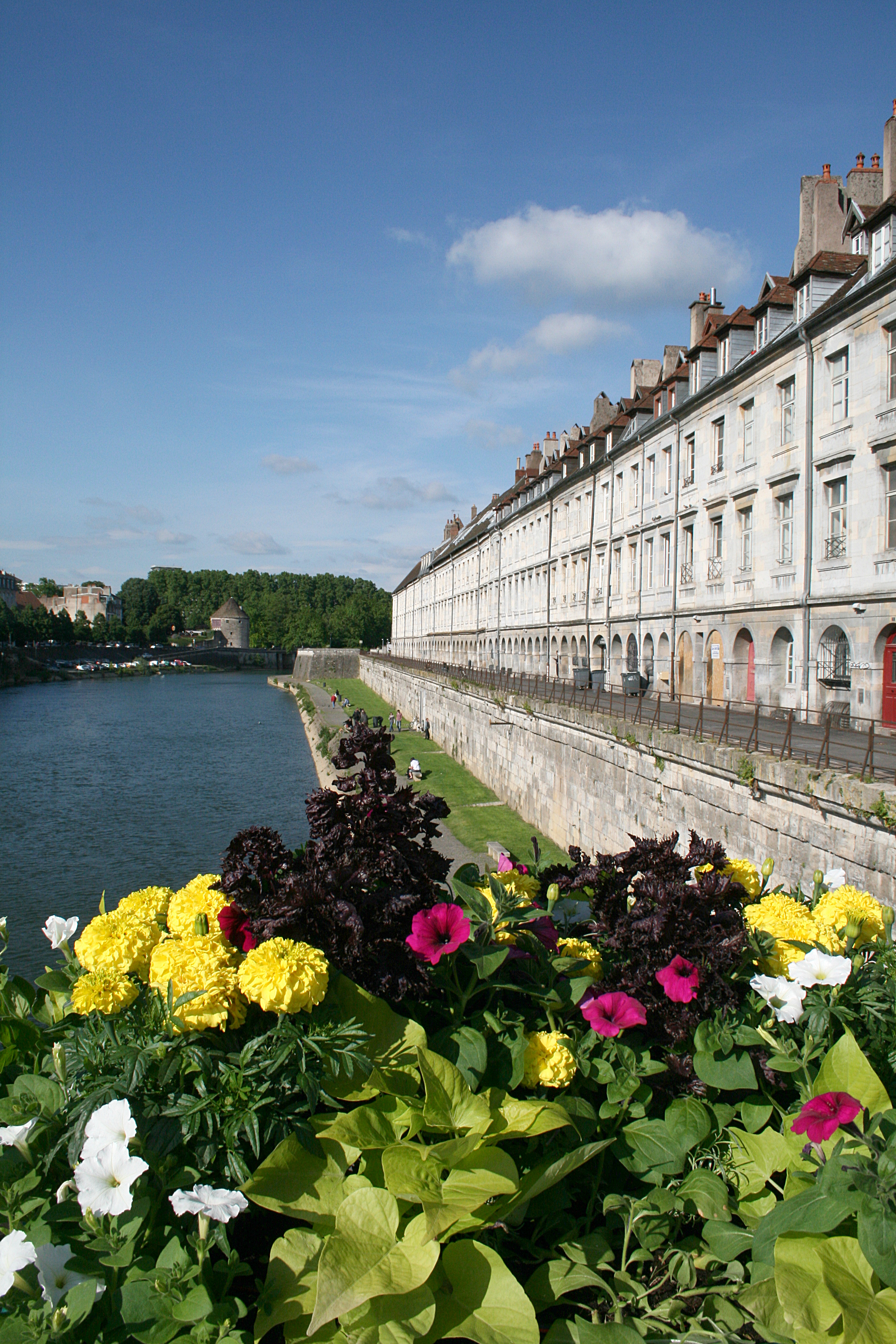
Français : Besançon (Doubs (département) - France), le Doubs, la Tour de la Pelote et le Quai Vauban avec l’ancien grenier de la ville vus du Pont Battant.
English: Besançon (Doubs - France), the Doubs river, the Tour de la Pelote and the Quai Vauban with the former granaries of the city seen from the Pont Battant. |
||
| Date | |||
| Source | Own work | ||
| Author | Jean-Pol GRANDMONT | ||
| Permission (Reusing this file) |
|

.JPG)
.JPG)

.JPG)
| Camera location | | View this and other nearby images on: OpenStreetMap |
|---|
.JPG¶ms=047.239753_N_0006.020789_E_globe:Earth_type:camera_region:FR_heading:337.50&language=en)
|
This building is classé au titre des monuments historiques de la France. It is indexed in the base Mérimée, a database of architectural heritage maintained by the French Ministry of Culture, under the reference PA00101612
|
|
This building is classé au titre des monuments historiques de la France. It is indexed in the base Mérimée, a database of architectural heritage maintained by the French Ministry of Culture, under the reference PA00101479
|
Licensing
I, the copyright holder of this work, hereby publish it under the following licenses:
This file is licensed under the Creative Commons Attribution-Share Alike 3.0 Unported license.
- You are free:
- to share – to copy, distribute and transmit the work
- to remix – to adapt the work
- Under the following conditions:
- attribution – You must give appropriate credit, provide a link to the license, and indicate if changes were made. You may do so in any reasonable manner, but not in any way that suggests the licensor endorses you or your use.
- share alike – If you remix, transform, or build upon the material, you must distribute your contributions under the same or compatible license as the original.

|
Permission is granted to copy, distribute and/or modify this document under the terms of the GNU Free Documentation License, Version 1.2 or any later version published by the Free Software Foundation; with no Invariant Sections, no Front-Cover Texts, and no Back-Cover Texts. A copy of the license is included in the section entitled GNU Free Documentation License. |
You may select the license of your choice.
File history
Click on a date/time to view the file as it appeared at that time.
| Date/Time | Dimensions | User | Comment | |
|---|---|---|---|---|
| current | 02:52, 20 August 2012 | 2,592 × 3,888 (4.83 MB) | Jean-Pol GRANDMONT | {{Information |Description ={{fr|1=Besançon (Doubs (département) - France), le Doubs, la Tour de la Pelote et le Quai Vauban avec l’ancien grenier de la ville... |
File usage
The following page uses this file:
.JPG)