File:20110419 bridge Akhurian River Ani Turkey.jpg
Size of this preview: 800 × 532 pixels. Other resolutions: 320 × 213 pixels | 640 × 426 pixels | 1,024 × 681 pixels | 1,280 × 852 pixels | 4,256 × 2,832 pixels.
Original file (4,256 × 2,832 pixels, file size: 12.01 MB, MIME type: image/jpeg)
This is a file from the Wikimedia Commons. The description on its description page there is shown below.
|
Summary
Description20110419 bridge Akhurian River Ani Turkey.jpg |
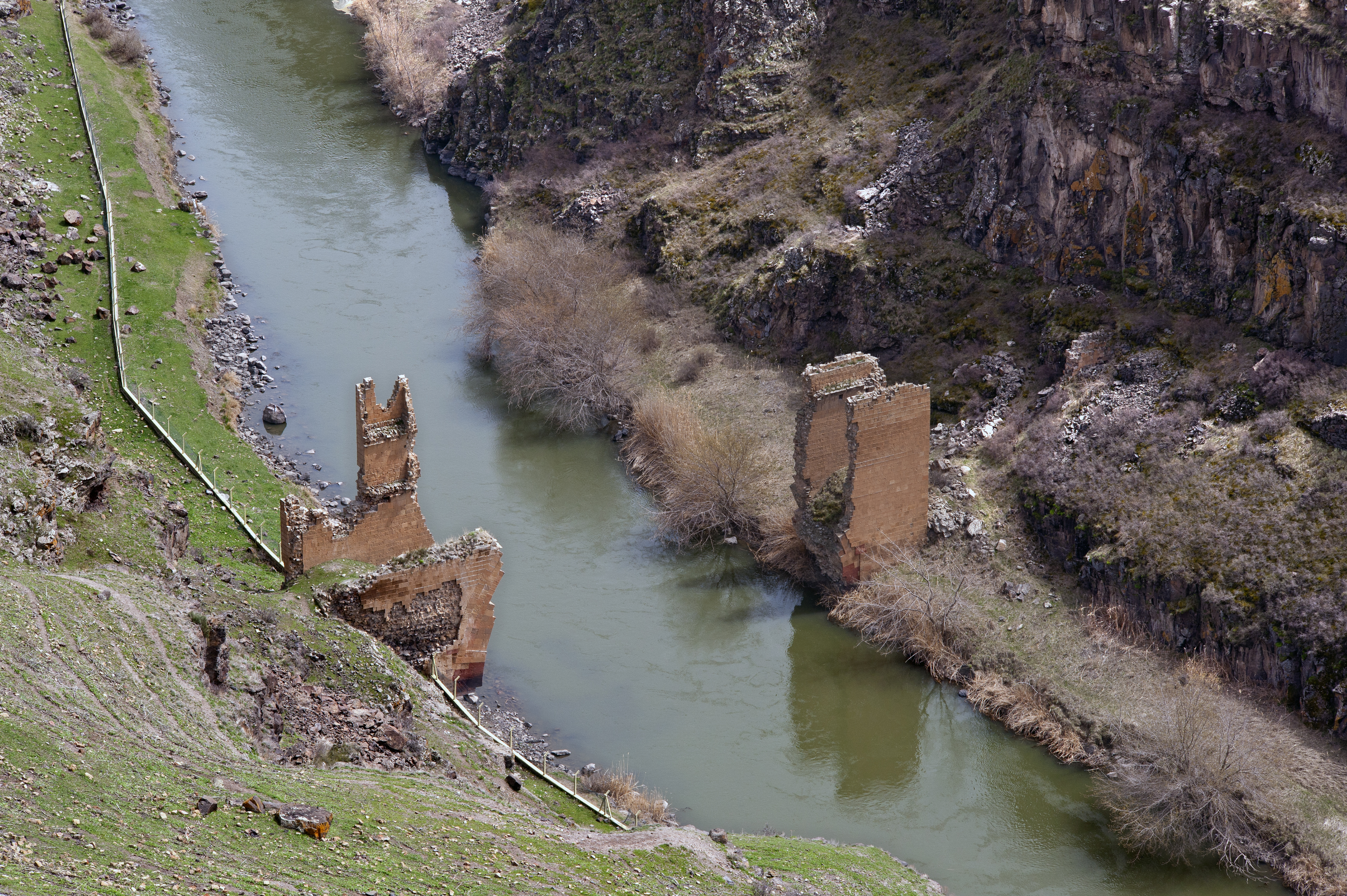
English: Ruins of the bridge over Akhurian River, Ani, Turkey.
Ελληνικά: Ερείπια της γέφυρας στο ποταμό Ακχουριάν, Ανί, Τουρκία. |
Date | |
Source | Own work |
Author | Ggia |
Permission (Reusing this file) |
I, the copyright holder of this work, hereby publish it under the following license: This file is licensed under the Creative Commons Attribution-Share Alike 3.0 Unported license.
|
Camera location | 40° 30′ 19.81″ N, 43° 34′ 12.6″ E | View this and other nearby images on: OpenStreetMap | 40.505502; 43.570167 |
---|
Annotations InfoField | This image is annotated: View the annotations at Commons |
112
21
673
1535
4256
2832
English: Turkish border fence.
Ελληνικά: Φράκτης Τουρκικών συνόρων.
58
1655
1538
1110
4256
2832
English: Turkey.
Ελληνικά: Τουρκία.
2240
108
1941
1780
4256
2832
English: Armenia.
Ελληνικά: Αρμενία.
Items portrayed in this file
depicts
40°30'19.807"N, 43°34'12.601"E
19 April 2011
image/jpeg
8f6938dda73e7962c30b35d5bd7fd4bc05b439a7
12,595,962 byte
2,832 pixel
4,256 pixel
File history
Click on a date/time to view the file as it appeared at that time.
Date/Time | Dimensions | User | Comment | |
---|---|---|---|---|
current | 02:18, 21 January 2013 | 4,256 × 2,832 (12.01 MB) | Slick-o-bot | Bot: convert to a non-interlaced jpeg image (see bugzilla:17645) |
File usage
The following page uses this file:
Metadata
This file contains additional information, probably added from the digital camera or scanner used to create or digitize it.
If the file has been modified from its original state, some details may not fully reflect the modified file.
Camera manufacturer | NIKON CORPORATION |
---|---|
Camera model | NIKON D700 |
Author | {georgios.giannopoulos at gmail.com} |
Copyright holder |
|
Exposure time | 1/800 sec (0.00125) |
F Number | f/8 |
ISO speed rating | 200 |
Date and time of data generation | 12:38, 19 April 2011 |
Lens focal length | 105 mm |
Latitude | 40° 30′ 19.81″ N |
Longitude | 43° 34′ 12.6″ E |
Altitude | 1,485 meters above sea level |
Orientation | Normal |
Horizontal resolution | 240 dpi |
Vertical resolution | 240 dpi |
File change date and time | 20:03, 10 June 2011 |
Exposure Program | Manual |
Exif version | 2.21 |
Date and time of digitizing | 12:38, 19 April 2011 |
APEX shutter speed | 9.643856 |
APEX aperture | 6 |
APEX exposure bias | 0 |
Maximum land aperture | 0 APEX (f/1) |
Metering mode | Pattern |
Light source | Fine weather |
Flash | Flash did not fire |
DateTime subseconds | 16 |
DateTimeOriginal subseconds | 16 |
DateTimeDigitized subseconds | 16 |
Color space | Uncalibrated |
Sensing method | One-chip color area sensor |
File source | Digital still camera |
Scene type | A directly photographed image |
Custom image processing | Normal process |
Exposure mode | Manual exposure |
White balance | Manual white balance |
Digital zoom ratio | 1 |
Focal length in 35 mm film | 105 mm |
Scene capture type | Standard |
Scene control | None |
Contrast | Normal |
Saturation | Normal |
Sharpness | Normal |
Subject distance range | Unknown |
GPS time (atomic clock) | 09:38 |
Satellites used for measurement | 09 |
Geodetic survey data used | WGS 84 |
GPS date | 19 April 2011 |
GPS tag version | 0.0.2.2 |
Lens used | 0.0 mm f/0.0 |
Serial number of camera | 2080897 |
Date metadata was last modified | 23:03, 10 June 2011 |
Rating (out of 5) | 0 |
Unique ID of original document | C8335C98EE782A3EA4BC9992277F248B |
IIM version | 31,864 |