File:AbuDisWall.jpg
No higher resolution available.
AbuDisWall.jpg (800 × 410 pixels, file size: 61 KB, MIME type: image/jpeg)
| This is a file from the Wikimedia Commons. The description on its description page there is shown below.
|
| Description |
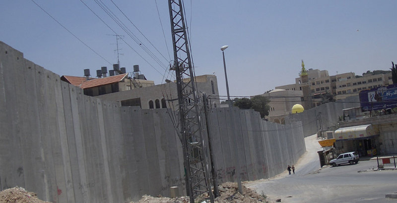
English: Israeli separation barrier at Abu Dis, June 2004. This picture shows a portion of the barrier being built by Israel in the West Bank. This part is in Abu Dis, close to the eastern part of Jerusalem. The photo was taken on the Jerusalem side of the wall, facing south. The local residents on both sides of the barrier at this point are predominantly Arabs.
Deutsch: Israelische Sperrmauer in Abu Dis nahe Ostjerusalems (Juni 2004). Das Photo zeigt die Mauer auf der Jerusalemer Seite Richtung Süden. An dieser Stelle sind die meisten Bewohner auf beiden Seiten der Mauer Araber. |
| Date | |
| Source | from en wikipedia where it was uploaded as own work |
| Author | Zero |
| Object location | | View this and other nearby images on: OpenStreetMap |
|---|
Zero0000 at the English-language Wikipedia, the copyright holder of this work, hereby publishes it under the following license:
| This file is licensed under the Creative Commons Attribution-Share Alike 3.0 Unported license. Subject to disclaimers. | ||
| Attribution: Zero0000 at the English-language Wikipedia | ||
| ||
| This licensing tag was added to this file as part of the GFDL licensing update. |

|
Permission is granted to copy, distribute and/or modify this document under the terms of the GNU Free Documentation License, Version 1.2 or any later version published by the Free Software Foundation; with no Invariant Sections, no Front-Cover Texts, and no Back-Cover Texts. A copy of the license is included in the section entitled GNU Free Documentation License. Subject to disclaimers. |
File history
Click on a date/time to view the file as it appeared at that time.
| Date/Time | Dimensions | User | Comment | |
|---|---|---|---|---|
| current | 06:16, 26 June 2005 | 800 × 410 (61 KB) | Matanya (usurped) | from en wikipedia. Israeli separation barrier at Abu Dis, June 2004 This picture shows a portion of the barrier being built by Israel in the West Bank. This part is in Abu Dis, close to the eastern part of Jerusalem. The photo was taken on the Jerusale |
File usage
The following page uses this file: