File:Arrondissement Charleroi Belgium Map.png
No higher resolution available.
Arrondissement_Charleroi_Belgium_Map.png (270 × 203 pixels, file size: 16 KB, MIME type: image/png)
| This is a file from the Wikimedia Commons. The description on its description page there is shown below.
|

|
File:Arrondissement Charleroi Belgium Map.svg is a vector version of this file. It should be used in place of this PNG file when not inferior.
File:Arrondissement Charleroi Belgium Map.png → File:Arrondissement Charleroi Belgium Map.svg
For more information, see Help:SVG. |
 |
Summary
| Description |
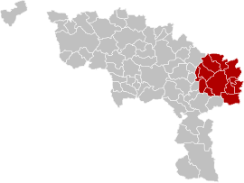
English: Map of Charleroi District in province of Hainaut, Belgium.
Français : Carte indiquant la localisation d'arrondissement de Charleroi dans la Province de Hainaut. |
| Source | Own work |
| Author | LennartBolks, colors by Nicnac25 |
colors changed by me, based on work from w:nl:Gebruiker:LennartBolks/kaartenhoekje also in PD.
Licensing
| This work has been released into the public domain by its author, LennartBolks. This applies worldwide. In some countries this may not be legally possible; if so: |
File history
Click on a date/time to view the file as it appeared at that time.
| Date/Time | Dimensions | User | Comment | |
|---|---|---|---|---|
| current | 07:51, 10 March 2019 | 270 × 203 (16 KB) | ArnePeirs | Update 2019 |
File usage
The following page uses this file: