File:Bangladesh location map.svg

Original file(SVG file, nominally 1,205 × 1,637 pixels, file size: 689 KB)

Commons-logo.svg This is a file from the Wikimedia Commons. The description on its description page there is shown below.
Commons is a freely licensed media file repository. You can help.

Summary

Description
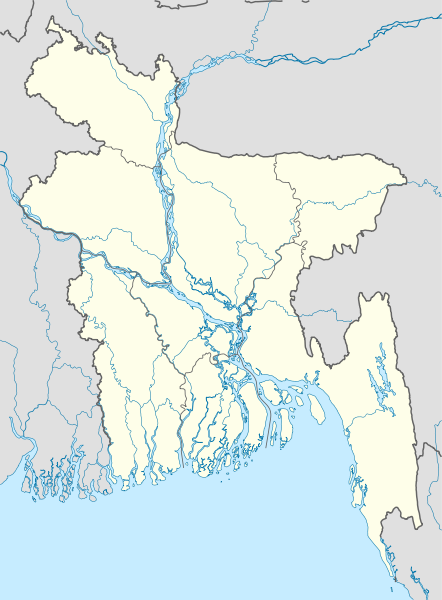
বাংলা: বাংলাদেশের অবস্থান মানচিত্র

সমদূরবর্তী সিলিন্ডারের আকৃতিবিশিষ্ট অভিক্ষেপণ, উত্তর/দক্ষিণ বিস্তৃতকরণ ১১০%। মানচিত্রের ভৌগোলিক সীমা:

  • উত্তর: ২৬.৮° উ
  • দক্ষিণ: ২০.৫° দ
  • পশ্চিম: ৮৭.৮° প
  • পূর্ব: ৯২.৯° পূর্ব
Deutsch: Positionskarte von Bangladesch

Quadratische Plattkarte, N-S-Streckung 110 %. Geographische Begrenzung der Karte:

  • N: 26.8° N
  • S: 20.5° N
  • W: 87.8° O
  • O: 92.9° O
English: Location map of Bangladesh

Equirectangular projection, N/S stretching 110 %. Geographic limits of the map:

  • N: 26.8° N
  • S: 20.5° N
  • W: 87.8° E
  • E: 92.9° E
Date
Source

Own work, using

  • United States National Imagery and Mapping Agency data
  • World Data Base II data
Author NordNordWest
Permission
(Reusing this file)

I have published this file as author NordNordWest under the "CC-BY-SA-3.0-DE" in Wikipedia. This means that free, commercial usage outside of Wikipedia is permitted under the following licence terms:

Please send me a specimen copy or the URL of the website where the file is used.

Please write an email to nnwest[at]web.de if you

  • need my postal address for sending a specimen copy
  • have further questions about the terms of the licence

PS: In case of refusal of the above terms the author reserves the right to take legal action.

w:en:Creative Commons
attribution share alike
This file is licensed under the Creative Commons Attribution-Share Alike 3.0 Germany license.
You are free:
  • to share – to copy, distribute and transmit the work
  • to remix – to adapt the work
Under the following conditions:
  • attribution – You must give appropriate credit, provide a link to the license, and indicate if changes were made. You may do so in any reasonable manner, but not in any way that suggests the licensor endorses you or your use.
  • share alike – If you remix, transform, or build upon the material, you must distribute your contributions under the same or compatible license as the original.
Other versions Derivative works of this file:  Bangladesh location map-Rangpur Division.svg
Kartenwerkstatt
This map has been made or improved in the German Kartenwerkstatt (Map Lab). You can propose maps to improve as well.

Captions

Add a one-line explanation of what this file represents

Items portrayed in this file

depicts

2 December 2009

image/svg+xml

e82e389b73ac326ca01a978a460a0f9a18923a0c

705,768 byte

1,637 pixel

1,205 pixel

File history

Click on a date/time to view the file as it appeared at that time.

Date/TimeDimensionsUserComment
current11:46, 27 January 20101,205 × 1,637 (689 KB)NordNordWestupdate

The following 2 pages use this file:

Metadata