File:Côte d'Ivoire map.png
No higher resolution available.
Côte_d'Ivoire_map.png (326 × 350 pixels, file size: 14 KB, MIME type: image/png)
| This is a file from the Wikimedia Commons. The description on its description page there is shown below.
|
Summary
| Description |
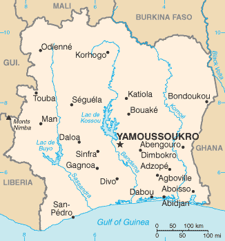
English: Map of Ivory Coast
Español: Mapa de Costa de Marfil mostrando al Bandama en el centro del país |
||
| Date | |||
| Source | CIA World Factbook | ||
| Author | CIA | ||
| Other versions |
|

Licensing
This image is in the public domain because it contains materials that originally came from the United States Central Intelligence Agency's World Factbook.
|
 |
File history
Click on a date/time to view the file as it appeared at that time.
| Date/Time | Dimensions | User | Comment | |
|---|---|---|---|---|
| current | 18:14, 6 April 2010 | 326 × 350 (14 KB) | Ras67 | cropped |
File usage
The following 4 pages use this file: