File:Cheshire outline map with UK.png
No higher resolution available.
Cheshire_outline_map_with_UK.png (722 × 552 pixels, file size: 412 KB, MIME type: image/png)
| This is a file from the Wikimedia Commons. The description on its description page there is shown below.
|
Summary
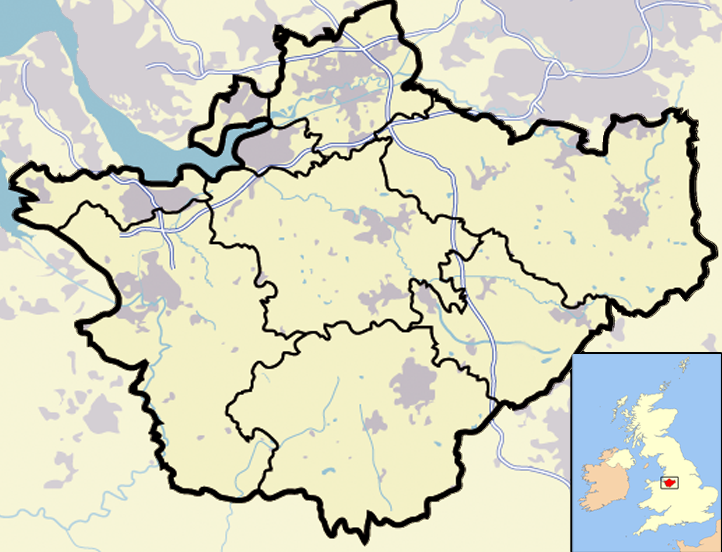
| Description | Map of en:Cheshire and surrounding area, with micromap of the British Isles for context. Urban areas are shown in grey, water bodies in light-blue, motorways in blue with white stripe and county and borough boundaries in black. |
| Date | 29 March 2007 (original upload date) |
| Source | Transferred from en.wikipedia to Commons. |
| Author | Jhamez84 at English Wikipedia |
| Other versions |
.png) (for boundaries expected to come into effect for 2009). (for boundaries expected to come into effect for 2009). |
Licensing
| This work has been released into the public domain by its author, Jhamez84 at English Wikipedia. This applies worldwide. In some countries this may not be legally possible; if so: Jhamez84 grants anyone the right to use this work for any purpose, without any conditions, unless such conditions are required by law. |
Original upload log
The original description page was here. All following user names refer to en.wikipedia.
- 2007-04-11 23:50 Jhamez84 722×552×8 (421996 bytes) correcting positioning of some urban areas (they were too east-northeasterly)
- 2007-04-11 17:14 Jhamez84 722×552×8 (420187 bytes) fixing issues in and around the [[M6 motorway]] (moving it to the west per discussion)
- 2007-04-11 00:38 Jhamez84 722×552×8 (438177 bytes) Much more detailed (and thus hopefully more accurate) version of the [[Cheshire]] map.
- 2007-03-29 23:48 Jhamez84 800×558×8 (446798 bytes) Map of [[Cheshire]] and surrounding area, with micromap of the British Isles for context. Urban areas are shown in grey, water bodies in light-blue, motorways in blue with white stripe and county and borough boundaries in black.
File history
Click on a date/time to view the file as it appeared at that time.
| Date/Time | Dimensions | User | Comment | |
|---|---|---|---|---|
| current | 06:02, 23 June 2008 | 722 × 552 (412 KB) | Jza84 | removed erroneous urban area |
File usage
There are no pages that use this file.