File:Dingo-Distribution-Fleming.png
Size of this preview: 800 × 486 pixels. Other resolutions: 320 × 194 pixels | 640 × 389 pixels | 1,024 × 622 pixels | 1,280 × 778 pixels | 2,150 × 1,306 pixels.
Original file (2,150 × 1,306 pixels, file size: 901 KB, MIME type: image/png)
| This is a file from the Wikimedia Commons. The description on its description page there is shown below.
|

|
This map image could be re-created using vector graphics as an SVG file. This has several advantages; see Commons:Media for cleanup for more information. If an SVG form of this image is available, please upload it and afterwards replace this template with
{{vector version available|new image name}}.
It is recommended to name the SVG file “Dingo-Distribution-Fleming.svg”—then the template Vector version available (or Vva) does not need the new image name parameter. |
Summary
| Description |
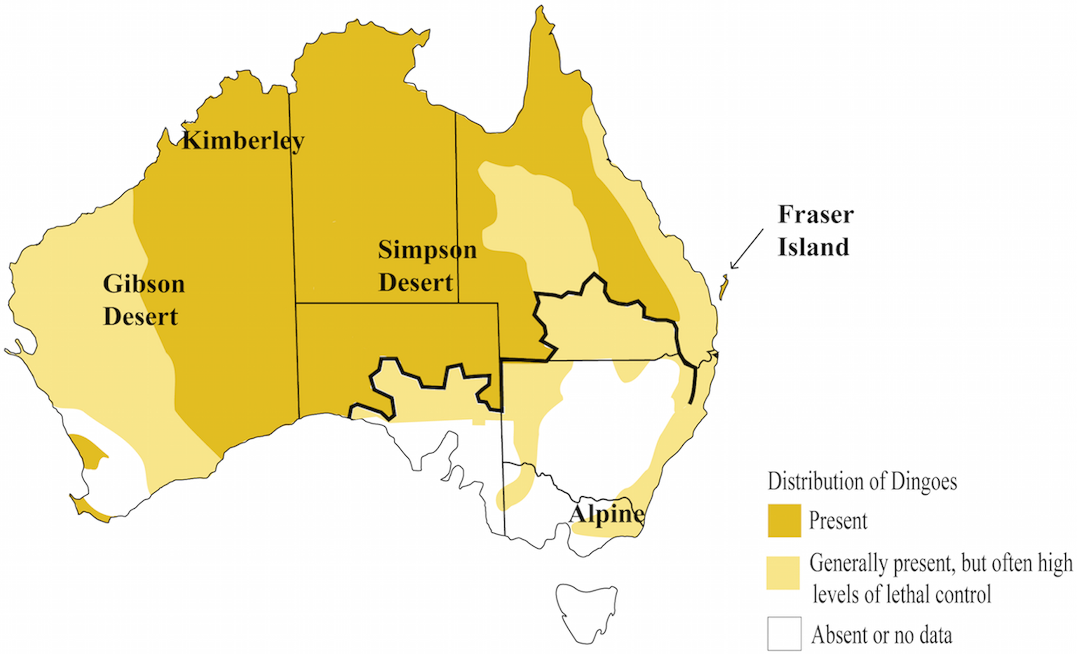
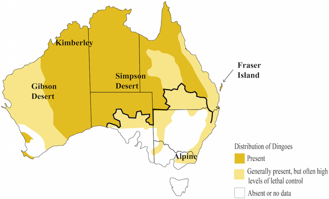
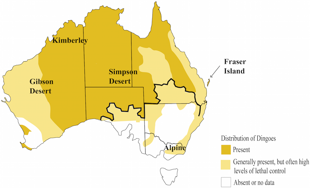
English: Distribution of the dingo |
| Date | |
| Source | Elucidating biogeographical patterns in Australian native canids using genome wide SNPs Cairns et al 2019, who compiled maps from Fleming 2001 and 2014. |
| Author | User:William Harris |
| Permission (Reusing this file) |
Open access |
| Other versions |
Licensing
This file is licensed under the Creative Commons Attribution-Share Alike 4.0 International license.
Attribution: International
- You are free:
- to share – to copy, distribute and transmit the work
- to remix – to adapt the work
- Under the following conditions:
- attribution – You must give appropriate credit, provide a link to the license, and indicate if changes were made. You may do so in any reasonable manner, but not in any way that suggests the licensor endorses you or your use.
- share alike – If you remix, transform, or build upon the material, you must distribute your contributions under the same or compatible license as the original.
File history
Click on a date/time to view the file as it appeared at that time.
| Date/Time | Dimensions | User | Comment | |
|---|---|---|---|---|
| current | 03:33, 9 May 2020 | 2,150 × 1,306 (901 KB) | William Harris | Updated for "Elucidating biogeographical patterns in Australian native canids using genome wide SNPs", Cairns et al 2018. Map compiled from Fleming 2001 and Fleming 2014. |
File usage
The following page uses this file: