File:Dust Plumes off Western Africa.jpg
Size of this preview: 466 × 599 pixels. Other resolutions: 187 × 240 pixels | 373 × 480 pixels | 467 × 600 pixels | 597 × 768 pixels | 796 × 1,024 pixels | 5,600 × 7,200 pixels.
Original file (5,600 × 7,200 pixels, file size: 3.24 MB, MIME type: image/jpeg)
| This is a file from the Wikimedia Commons. The description on its description page there is shown below.
|
Summary
| Description |
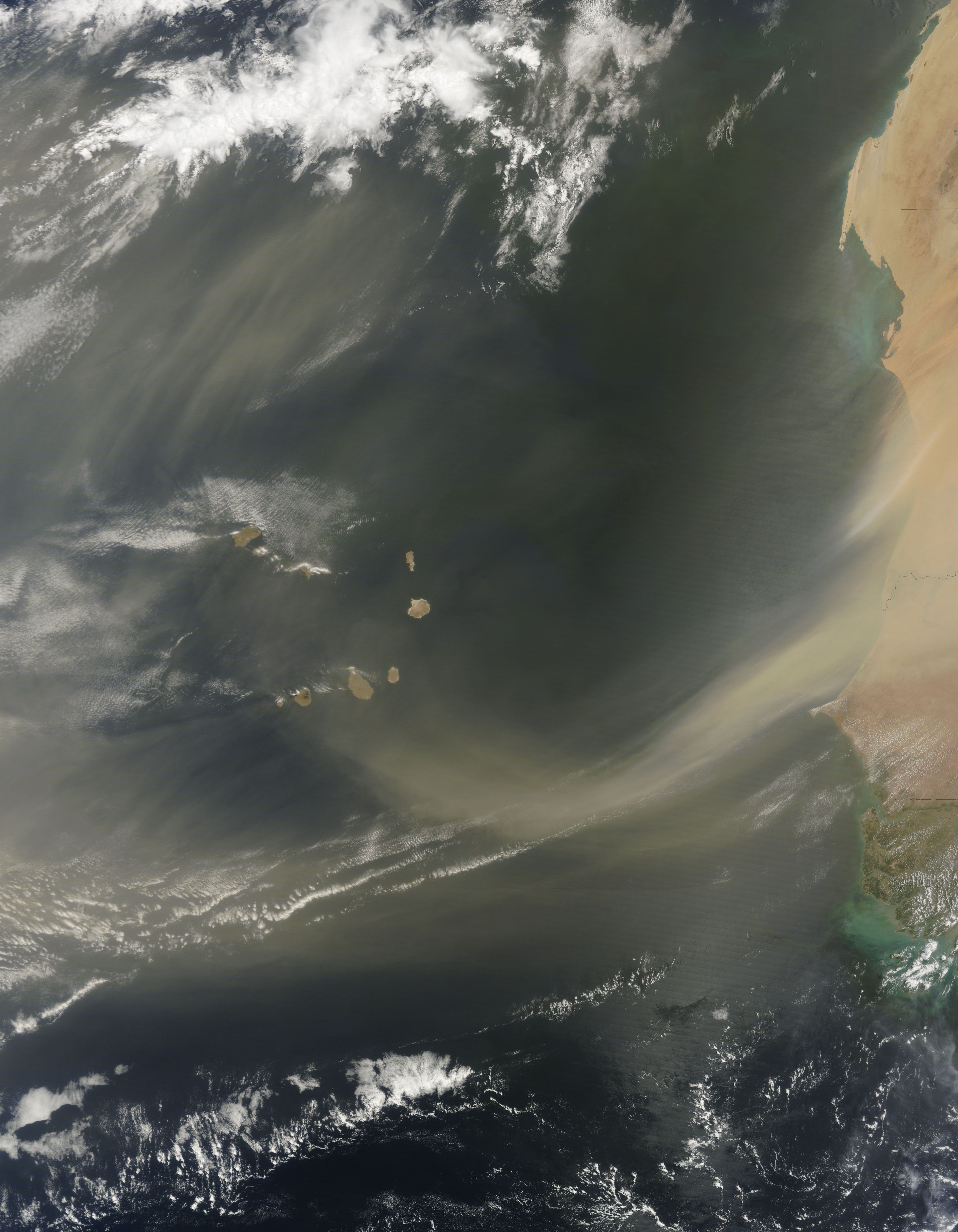
English: Saharan sand blowing off the coasts of Mauritania and Senegal. Two dust plumes blow toward the south west, one plume stretching possibly 150 kilometres off the coast, and the other plume forming an arc that reaches all the way to Cape Verde. Thinner but larger plumes of dust hover over the Atlantic west and north of the island archipelago. Although this image shows dust immediately off the coast of West Africa, a layer of dust from storms such as this often travels virtually intact to the other side of the Atlantic. This layer of dry, hot, dusty air is called the Saharan Air Layer. |
| Date | |
| Source | NASA Earth Observatory |
| Author | Jeff Schmaltz |
Image created by the MODIS Rapid Response Team, Goddard Space Flight Centre. Instrument: Terra - MODIS
Licensing
| This file is in the public domain in the United States because it was solely created by NASA. NASA copyright policy states that "NASA material is not protected by copyright unless noted". (See Template:PD-USGov, NASA copyright policy page or JPL Image Use Policy.) | ||
 |
Warnings:
|
File history
Click on a date/time to view the file as it appeared at that time.
| Date/Time | Dimensions | User | Comment | |
|---|---|---|---|---|
| current | 02:03, 24 June 2009 | 5,600 × 7,200 (3.24 MB) | Originalwana | {{Information |Description={{en|1=Saharan sand blowing off the coasts of Mauritania and Senegal. Two dust plumes blow toward the south west, one plume stretching possibly 150 kilometres off the coast, and the other plume forming an arc that reaches all th |
File usage
The following page uses this file: