File:Iraqi Kurdistan in Iraq (de-facto and disputed hatched).svg

Size of this PNG preview of this SVG file: 589 × 600 pixels. Other resolutions: 236 × 240 pixels | 471 × 480 pixels | 754 × 768 pixels | 1,005 × 1,024 pixels | 1,241 × 1,264 pixels.
Original file (SVG file, nominally 1,241 × 1,264 pixels, file size: 545 KB)
| This is a file from the Wikimedia Commons. The description on its description page there is shown below.
|
Summary
| Description |
Bân-lâm-gú: Kurdistan tī Iraq ê ūi-tì
Iraq koaⁿ-hong tēng ê Kurdistan Tē-he̍k Iraq Kurdistan khòng-chè ê thó͘-tē Iraq Kurdistan chú-tiuⁿ ê thó͘-tē Iraq kî-tha pō͘-hūn Català: Kurdistan Iraquí
Límits oficials de la regió kurda Territori controlat pel Kurdistan Iraquí Territory reivindicat pel Kurdistan Iraquí Dansk: Kort over Irakisk Kurdistan i Irak
Officielle grænser for Regionen Irakisk Kurdistan Andre områder kontrolleret af Irakisk Kurdistan Territorier som Irakisk Kurdistan gør krav på Øvrige Irak Deutsch: Die Lage Kurdistans im Irak
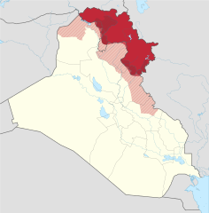
Offizielles Gebiet der Autonomen Region Kurdistan Eingegliederte Gebiete (nicht offiziell anerkannt) Von der Autonomen Region Kurdistans beanspruchte und besetzte Gebiete Von der Autonomen Region Kurdistans beanspruchte Gebiete Der Rest des Iraks Grenzen der Autonomen Region Kurdistans (inkl. der eingegliederten Gebiete) Grenze vor 2014 English: Location of Kurdistan in Iraq
Borders of the Kurdistan Region (disputed) Pre-2014 borders Recognised territory of the Kurdistan Region Disputed territory incorporated into the Kurdistan Region Other territory claimed and controlled by the Kurdistan Regional Government (approximate) Other territory claimed by the Kurdistan Regional Government Rest of Iraq Español: Ubicación de Kurdistan Iraquí
Fronteras oficiales de la región. Territorio ocupado por el Kurdistan Iraquí Territorio reclamado por el Kurdistan Iraquí. El resto de Irak. Français : Le Kurdistan irakien en Irak
Frontières officielles du Kurdistan irakien Territoire incorporé par le Kurdistan irakien Territoire revendiqué par le Kurdistan irakien Reste de l'Irak Italiano: Ubicazione del Kurdistan in Iraq
Confini della Regione del Kurdistan (contesi) Confini precedenti al 2014 Territorio riconosciuto ufficialmente della Regione del Kurdistan Territorio conteso incorporato nella Regione del Kurdistan Altri territori reclamati e amministrati dal governo regionale curdo (approssimativi) Altri territori reclamati dal governo regionale curdo Il resto dell'Iraq Magyar: Iraki Kurdisztán területe Irakon belül
Iraki Kurdisztán hivatalos területe a kurdok által elfoglalt terület (nem hivatalos) Iraki Kurdisztán által igényelt és elfoglalt terület Iraki Kurdisztán által igényelt terület Irak maradék területe Kurdisztáni Autonóm Régió határa A határ 2014 előtt Nederlands: Ligging van Koerdistan in Irak
Officiële grondgebied van Iraaks-Koerdistan Gebied ingelijfd door Iraaks-Koerdistan Gebied opgeëist door Iraaks-Koerdistan Overig Irak Suomi: Kurdistanin sijainti Irakissa
Irakin Kurdistanin autonominen alue Irakin Kurdistaniin kuuluvat alueet Irakin Kurdistanin vaatimat alueet Irakin valtion hallitsemat alueet Русский: Курдистан на карте Ирака
Официальные границы автономного региона Иракский Курдистан Территория, контролируемая силами Иракского Курдистана Территория, на которую претендует Иракский Курдистан Прочие территории Ирака 日本語: イラク領クルド人自治区 イラク
イラク中央政府が公式に定めたクルド人自治区の領域 イラク・クルド自治政府が併合し実効支配している領域 イラク・クルド自治政府が領有を主張する領域 その他のイラク国土 فارسی : اقلیم کردستان عراق
منطقهٔ رسمی کردستان عراق (در دست دولت کردستان) بخشهای اشغالشده توسط کردستان عراق دیگر بخشهای موردادعای کردستان عراق (در دست دولت مرکزی یا در اشغال داعش) دیگر منطقههای عراق |
||||
| Date | |||||
| Source | This SVG locator map includes elements from this locator map: This SVG locator map includes elements from this locator map: |
||||
| Author |
Spesh531, TUBS |
||||
| Other versions |
|
||||
| SVG development | |||||
.svg)
.svg)
.svg)
.svg)
.svg)
.svg)
.svg)

-en.svg)

.svg)
.svg)
.svg)

_(US48).svg)
_(small_islands_magnified)_(-mini_map_-rivers).svg)
.svg)
_(extra_close)_(US48).svg)
.svg)
_(zoom).svg)

.svg)


_(UNMIK).svg)
.svg)
_(disputed_hatched).svg)
_(claimed_and_disputed_hatched).svg)
.svg)
.svg)
_(%2Ball_claims_hatched).svg)

.svg)
_(shade).svg)
_(shade)_(special_marker).svg)
_(-mini_map).svg)
_(-mini_map).svg)
_(-mini_map).svg)


.svg)

.svg)
.svg)
Licensing
This file is licensed under the Creative Commons Attribution-Share Alike 3.0 Unported license.
- You are free:
- to share – to copy, distribute and transmit the work
- to remix – to adapt the work
- Under the following conditions:
- attribution – You must give appropriate credit, provide a link to the license, and indicate if changes were made. You may do so in any reasonable manner, but not in any way that suggests the licensor endorses you or your use.
- share alike – If you remix, transform, or build upon the material, you must distribute your contributions under the same or compatible license as the original.
References
Official territory and governorate borders
- http://www.krso.net/Default.aspx?page=article&id=1142
- http://www.economist.com/images/20070908/CMA980.gif
Claimed territory
- http://www.aina.org/reports/pcok.pdf (page 13)
- http://www.economist.com/images/20070908/CMA980.gif
- http://photos1.blogger.com/blogger/6564/131/1600/Kurdistan_july05_claimed-767346.jpg
- http://images.fastcompany.com/magazine/144/feature-84-Kurdistan-OilMap-pop.jpg
- http://news.bbcimg.co.uk/media/images/76876000/gif/_76876578_iraq_kurdistan_624.gif
File history
Click on a date/time to view the file as it appeared at that time.
| Date/Time | Dimensions | User | Comment | |
|---|---|---|---|---|
| current | 16:01, 19 July 2018 | 1,241 × 1,264 (545 KB) | Rob984 | dashed official KRG border on the basis that it's disputed by Baghdad. |
File usage
The following 2 pages use this file:
.svg)