File:ItalianMareNostrum.jpg
Size of this preview: 800 × 402 pixels. Other resolutions: 320 × 161 pixels | 640 × 322 pixels | 1,254 × 630 pixels.
Original file (1,254 × 630 pixels, file size: 319 KB, MIME type: image/jpeg)
| This is a file from the Wikimedia Commons. The description on its description page there is shown below.
|
Summary
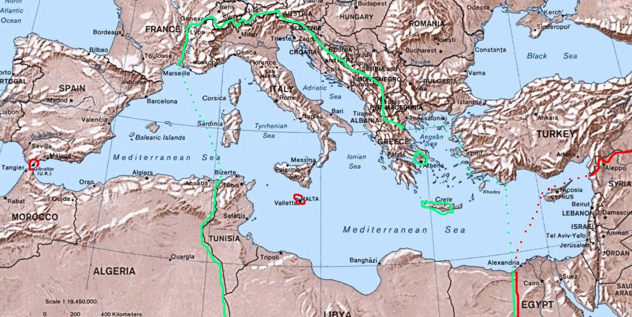
| Description | Map of Italian "Mare Nostrum" (Italian Mediterranean), showing inside the green line & dots the italian areas in the Mediterranean sea during summer 1942 (in red those under British control). The remaining areas were under Axis control (Germany,Bulgary and Vichy France) and under friendly neutrality (Spain, Turkey). |
| Date | |
| Source | self-made (I have based my work on the original Commons Image:Mediterranean Relief.jpg, licensed PD-USGov) |
| Author | Brunodambrosio |
| Other versions |
File:GreaterItalia.jpg File:ProgettoImperoItaliano.jpg |
Licensing
| I, the copyright holder of this work, release this work into the public domain. This applies worldwide. In some countries this may not be legally possible; if so: I grant anyone the right to use this work for any purpose, without any conditions, unless such conditions are required by law. |
File history
Click on a date/time to view the file as it appeared at that time.
| Date/Time | Dimensions | User | Comment | |
|---|---|---|---|---|
| current | 19:21, 20 August 2007 | 1,254 × 630 (319 KB) | Brunodambrosio | {{Information |Description=Map of Italian "Mare Nostrum" (Italian Mediterranean), showing inside the green line & dots the italian areas in the Mediterranean sea during summer 1942 (in red those under British control). The remaining areas were under Axis |
File usage
The following 3 pages use this file: