File:Landlocked countries.png
Size of this preview: 800 × 351 pixels. Other resolutions: 320 × 140 pixels | 640 × 281 pixels | 1,425 × 625 pixels.
Original file (1,425 × 625 pixels, file size: 54 KB, MIME type: image/png)
| This is a file from the Wikimedia Commons. The description on its description page there is shown below.
|

|
File:Landlocked countries.svg is a vector version of this file. It should be used in place of this PNG file when not inferior.
File:Landlocked countries.png → File:Landlocked countries.svg
For more information, see Help:SVG. |
 |
Summary
| Description | |
| Date | |
| Source | Own work |
| Author | Ævar Arnfjörð Bjarmason |
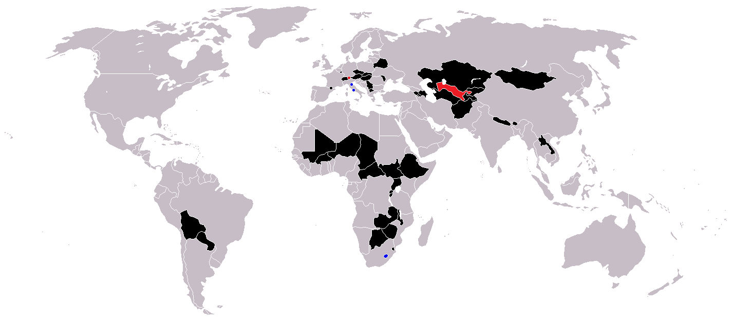
Countries coloured black on the map
Countries coloured red on the map (double landlocked)
Countries coloured blue on the map (landlocked by a single country)
Licensing
| I, the copyright holder of this work, release this work into the public domain. This applies worldwide. In some countries this may not be legally possible; if so: I grant anyone the right to use this work for any purpose, without any conditions, unless such conditions are required by law. |
File history
Click on a date/time to view the file as it appeared at that time.
| Date/Time | Dimensions | User | Comment | |
|---|---|---|---|---|
| current | 05:36, 1 June 2018 | 1,425 × 625 (54 KB) | LamBoet | Reverted to version as of 16:39, 15 July 2011 (UTC) - Restore blue color for countries that are landlocked by a single country |
File usage
There are no pages that use this file.