File:Lissewege Spoorwegbatterij R01.jpg

Size of this preview: 800 × 475 pixels. Other resolutions: 320 × 190 pixels | 640 × 380 pixels | 1,024 × 608 pixels | 1,280 × 760 pixels | 3,580 × 2,125 pixels.
Original file (3,580 × 2,125 pixels, file size: 4.56 MB, MIME type: image/jpeg)
| This is a file from the Wikimedia Commons. The description on its description page there is shown below.
|
Summary
| Description |
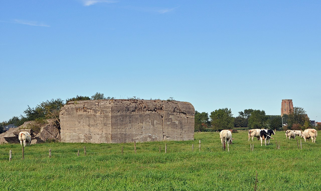
English: Lissewege (Bruges, Belgium): German blockhouse, part of the Atlantic Wall (WW 2)
Français : Lissewege (Bruges, Belgique): blockhaus allemand ayant fait partie du Mur de l'Atlantique (deuxième guerre mondiale)
Nederlands: Lissewege (Brugge, België): bunker van een Duitse spoorwegbatterij, onderdeel van de Atlantikwall (Tweede Wereldoorlog)
Deutsch: Lissewege (Brügge, Belgien): Deutscher Bunker (Atlantikwall, Zweiter Weltkrieg)
|
||
| Date | 15 August 2011 (according to Exif data) | ||
| Source | Own work | ||
| Author | Marc Ryckaert (MJJR) |
| Camera location | | View this and other nearby images on: OpenStreetMap |
|---|

|
This image was uploaded as part of Wiki Loves Monuments 2011.
|
 |
Licensing
I, the copyright holder of this work, hereby publish it under the following license:
This file is licensed under the Creative Commons Attribution-Share Alike 3.0 Unported license.
- You are free:
- to share – to copy, distribute and transmit the work
- to remix – to adapt the work
- Under the following conditions:
- attribution – You must give appropriate credit, provide a link to the license, and indicate if changes were made. You may do so in any reasonable manner, but not in any way that suggests the licensor endorses you or your use.
- share alike – If you remix, transform, or build upon the material, you must distribute your contributions under the same or compatible license as the original.
This image has been assessed using the Quality image guidelines and is considered a Quality image.
|
File history
Click on a date/time to view the file as it appeared at that time.
| Date/Time | Dimensions | User | Comment | |
|---|---|---|---|---|
| current | 13:46, 13 September 2011 | 3,580 × 2,125 (4.56 MB) | MJJR | {{Information |Description = {{en|1=Lissewege (Bruges, Belgium): German blockhouse, part of the ''Atlantic Wall'' (WW 2)}} {{fr|1=Lissewege (Bruges, Belgique): blockhaus allemand ayant fait partie du Mur de l'Atlantique (deuxième guerre mondiale)}} {{nl| |
File usage
The following page uses this file: