File:LocatorMap Malacca Strait.png

Size of this preview: 800 × 523 pixels. Other resolutions: 320 × 209 pixels | 640 × 419 pixels | 916 × 599 pixels.
Original file (916 × 599 pixels, file size: 13 KB, MIME type: image/png)
| This is a file from the Wikimedia Commons. The description on its description page there is shown below.
|
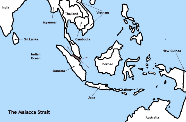
| Description | The Malacca Strait | ||
| Date | |||
| Source | Own work | ||
| Author | TBjornstad 15:21, 27 August 2006 (UTC) | ||
| Permission (Reusing this file) |
|
File history
Click on a date/time to view the file as it appeared at that time.
| Date/Time | Dimensions | User | Comment | |
|---|---|---|---|---|
| current | 08:21, 27 August 2006 | 916 × 599 (13 KB) | ToB | {{Information |Description=The Malacca Strait |Source= |Date=August 27th 2006 |Author=~~~~ |Permission=Public Domain |other_versions=None }} Category:Maps of Oceania |
File usage
The following 2 pages use this file: