File:Manhattan Highlight New York City Map Julius Schorzman.png

Size of this preview: 616 × 600 pixels. Other resolutions: 247 × 240 pixels | 493 × 480 pixels | 789 × 768 pixels | 1,052 × 1,024 pixels | 2,652 × 2,582 pixels.
Original file (2,652 × 2,582 pixels, file size: 4.68 MB, MIME type: image/png)
| This is a file from the Wikimedia Commons. The description on its description page there is shown below.
|
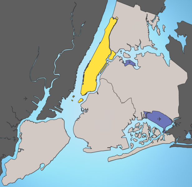
A map of New York City with Manhattan highlighted.
Notes:
- Marble Hill is shown as part Manhattan, part Bronx. See Wikipedia:Marble Hill, Manhattan, New York for more information.
- Governors Island, Ellis Island, Liberty Island, Randall's Island, and Roosevelt Island are highlighted since they are in New York County and are governmentally a part of Manhattan.
Source: I created this image using various maps and images. Attribution: Julius Schorzman
This file is licensed under the Creative Commons Attribution-Share Alike 2.5 Generic license.
- You are free:
- to share – to copy, distribute and transmit the work
- to remix – to adapt the work
- Under the following conditions:
- attribution – You must give appropriate credit, provide a link to the license, and indicate if changes were made. You may do so in any reasonable manner, but not in any way that suggests the licensor endorses you or your use.
- share alike – If you remix, transform, or build upon the material, you must distribute your contributions under the same or compatible license as the original.
File history
Click on a date/time to view the file as it appeared at that time.
| Date/Time | Dimensions | User | Comment | |
|---|---|---|---|---|
| current | 18:59, 18 August 2005 | 2,652 × 2,582 (4.68 MB) | Quasipalm | A map of New York City with Manhattan highlighted. Notes: # '''Marble Hill''' is shown as part Manhattan, part Bronx. See wiki:Marble Hill for more information. # '''Governors Island''', '''Ellis Island''', '''Liberty Island''', '''Randall's Island' |
File usage
There are no pages that use this file.