File:Map of USA MI.svg

Size of this PNG preview of this SVG file: 286 × 186 pixels. Other resolutions: 320 × 208 pixels | 640 × 416 pixels | 800 × 520 pixels | 1,024 × 666 pixels | 1,280 × 832 pixels.
Original file (SVG file, nominally 286 × 186 pixels, file size: 167 KB)
| This is a file from the Wikimedia Commons. The description on its description page there is shown below.
|
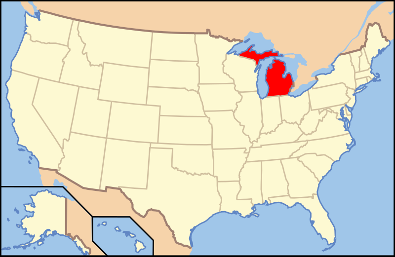
Clickable version
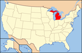
| Description | Map of USA with Michigan highlighted | ||||||||
| Date | see file history below. | ||||||||
| Source |
Own work This vector image includes elements that have been taken or adapted from this file: |
||||||||
| Author |
|
||||||||
| Permission (Reusing this file) |
This file is licensed under the Creative Commons Attribution 2.0 Generic license.
|
||||||||
| Other versions |
|
||||||||
| SVG development |


File history
Click on a date/time to view the file as it appeared at that time.
| Date/Time | Dimensions | User | Comment | |
|---|---|---|---|---|
| current | 00:08, 9 June 2006 | 286 × 186 (167 KB) | Huebi~commonswiki | {{Information| |Description=Map of USA with Michigan highlighted |other_versions=image:Map of USA with state names.svg }} Category:Maps of the United States Category:Maps of Michigan Category:SVG maps {{GFDL-en}}{{cc-by-2.0}}{{cc-by-sa- |
File usage
The following 15 pages use this file:
- Allegan County, Michigan
- Barry County, Michigan
- Calhoun County, Michigan
- Cass County, Michigan
- Eaton County, Michigan
- Emmet County, Michigan
- Gogebic County, Michigan
- Grand Traverse County, Michigan
- Lake County, Michigan
- Luce County, Michigan
- Midland County, Michigan
- Monroe County, Michigan
- Shiawassee County, Michigan
- Van Buren County, Michigan
- Washtenaw County, Michigan