File:Map of Wyoming highlighting Platte County.svg

Size of this PNG preview of this SVG file: 783 × 599 pixels. Other resolutions: 314 × 240 pixels | 627 × 480 pixels | 784 × 600 pixels | 1,003 × 768 pixels | 1,280 × 980 pixels | 5,883 × 4,504 pixels.
Original file (SVG file, nominally 5,883 × 4,504 pixels, file size: 26 KB)
| This is a file from the Wikimedia Commons. The description on its description page there is shown below.
|
Summary
| Description |
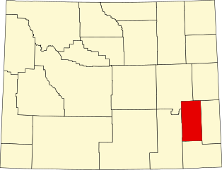
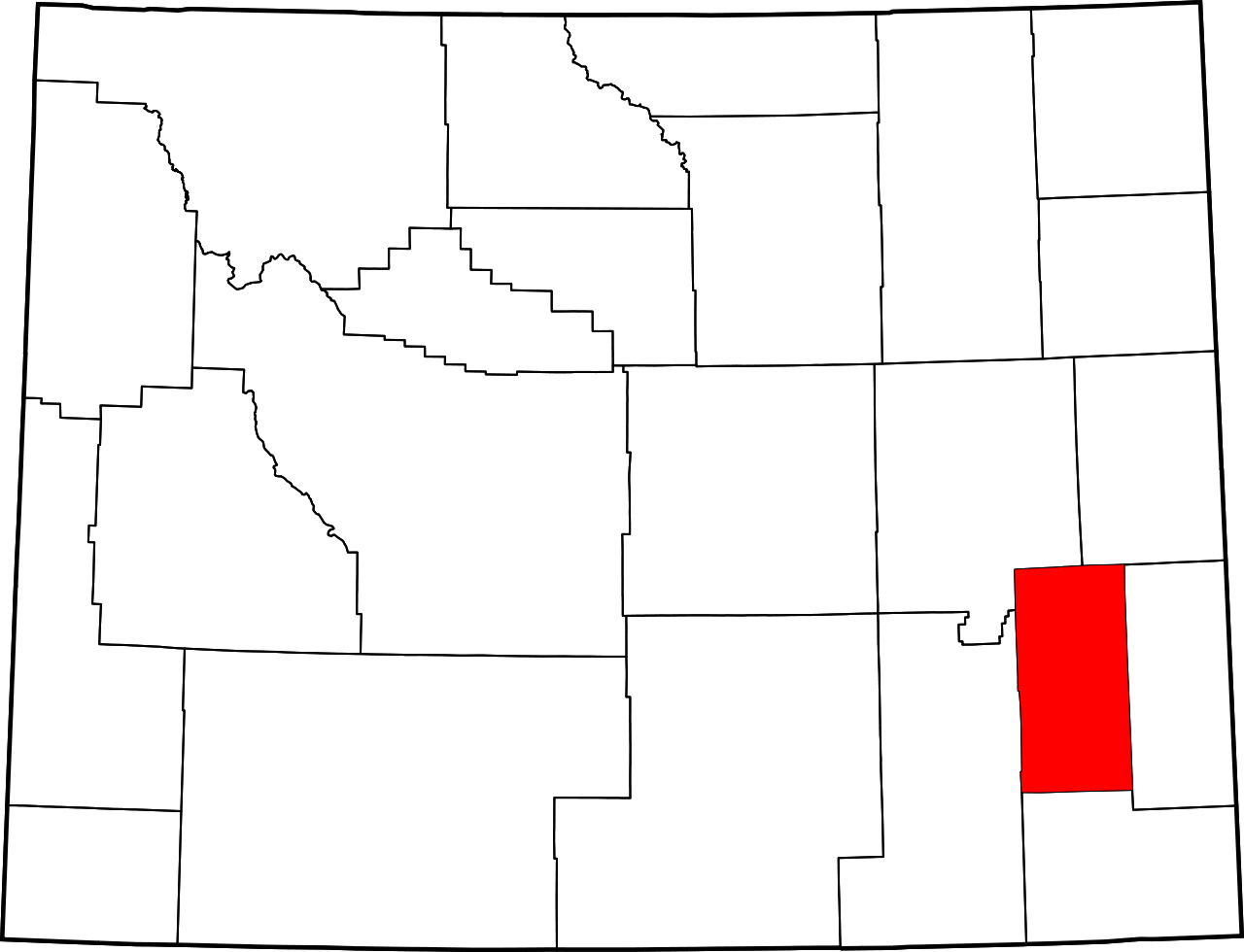
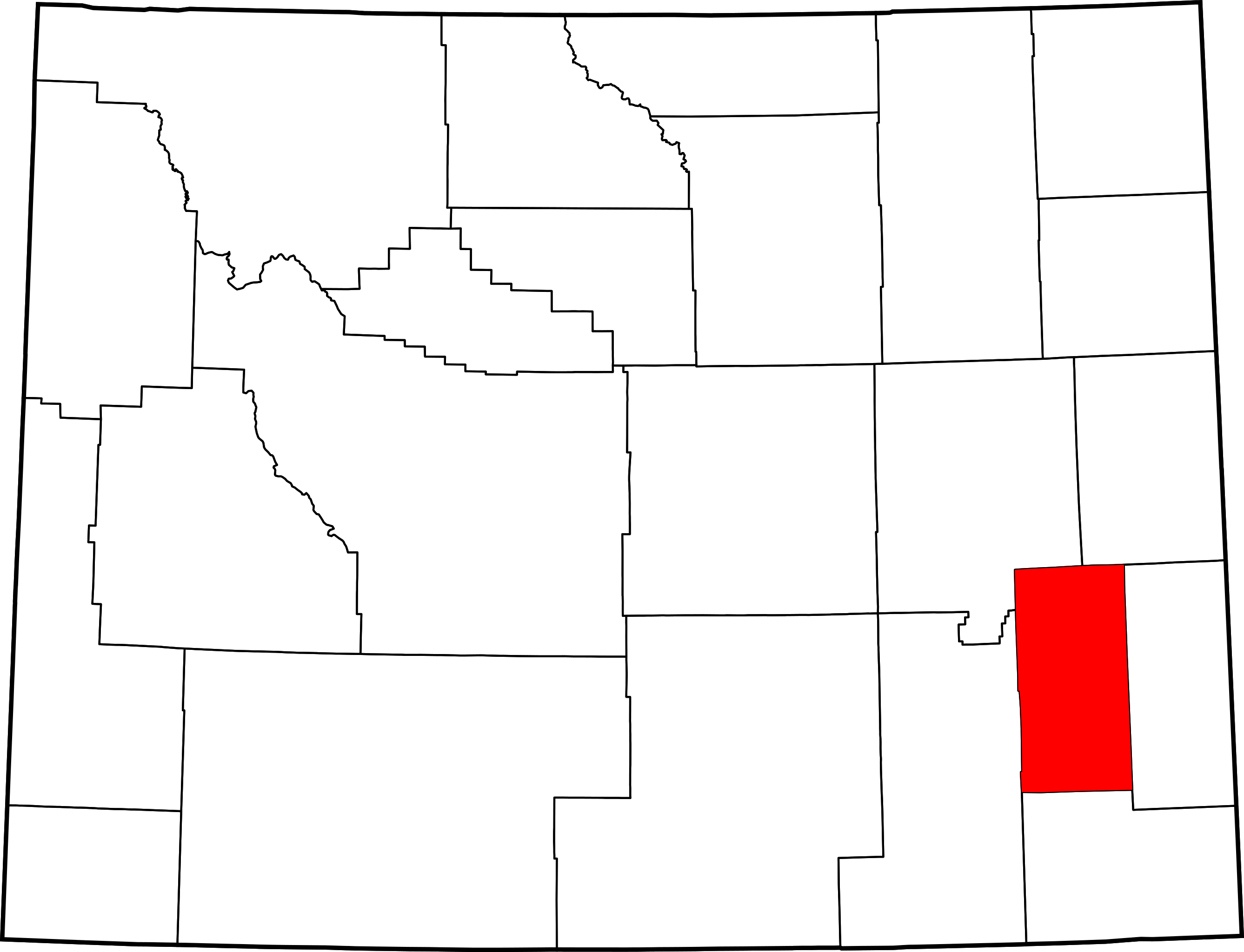
English: This is a locator map showing Platte County in Wyoming. For more information, see Commons:United States county locator maps. |
| Date | |
| Source |
Own work: English: The maps use data from nationalatlas.gov, specifically countyp020.tar.gz on the Raw Data Download page. The maps also use state outline data from statesp020.tar.gz. The Florida maps use hydrogm020.tar.gz to display Lake Okeechobee. |
| Author | David Benbennick |
Licensing
| I, the copyright holder of this work, release this work into the public domain. This applies worldwide. In some countries this may not be legally possible; if so: I grant anyone the right to use this work for any purpose, without any conditions, unless such conditions are required by law. |
File history
Click on a date/time to view the file as it appeared at that time.
| Date/Time | Dimensions | User | Comment | |
|---|---|---|---|---|
| current | 11:25, 12 February 2006 | 5,883 × 4,504 (26 KB) | David Benbennick | {{subst:User:Dbenbenn/clm|county=Platte County|state=Wyoming|type=county}} |
File usage
The following 2 pages use this file: