File:Narbonne Cathedrale Saint Just et Saint Pasteur.jpg

Size of this preview: 794 × 600 pixels. Other resolutions: 318 × 240 pixels | 636 × 480 pixels | 1,017 × 768 pixels | 1,280 × 967 pixels | 8,225 × 6,212 pixels.
Original file (8,225 × 6,212 pixels, file size: 11.14 MB, MIME type: image/jpeg)
| This is a file from the Wikimedia Commons. The description on its description page there is shown below.
|
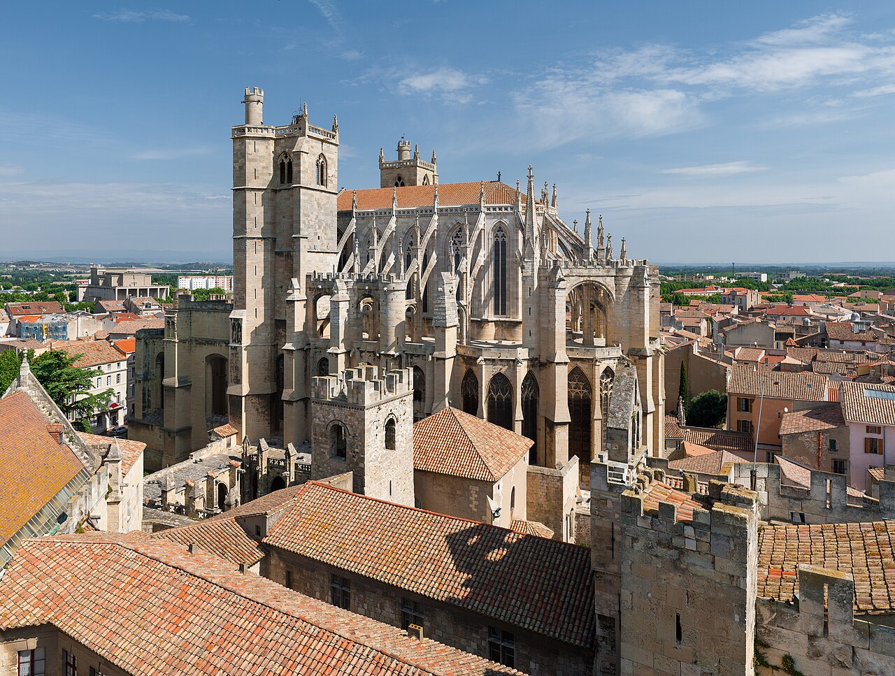
This image was selected as picture of the day on Wikimedia Commons for 18 February 2009. It was captioned as follows: English: Saint-Just and Saint-Pasteur Cathedral, in Narbonne, south of France, seen from the Gilles Aycelin dungeon Other languages:
Afrikaans: Die Sint-Just en Sint-Pasteur Katedraal, te Narbonne, suid-Frankryk, soos gesien vanuit die Gilles Aycelin kerker Dansk: Katedralen i den sydfranske by Narbonne. English: Saint-Just and Saint-Pasteur Cathedral, in Narbonne, south of France, seen from the Gilles Aycelin dungeon Español: Catedral de los Santos Justo y Pastor, en Narbona (Aude, sur de Francia), vista de desde el torreón Gilles Aycelin. Français : La cathédrale Saint-Just-et-Saint-Pasteur à Narbonne (France) vue du donjon Gilles Aycelin. Italiano: La cattedrale di Narbona, Francia. Magyar: A Narbonne-i katedrális az öregtoronyról nézve Nederlands: De Saint-Just-et-Saint-Pasteur-kathedraal in de Franse stad Narbonne, gezien vanaf de donjon Gilles Aycelin. Polski: Katedra w mieście Narbonne w południowej Francji. Português: As catedrais de Saint-Just e Saint-Pasteur, em Narbonne, Sul de França Română: Catedrala Saint-Just și Saint-Pasteur, din Narbonne, Franța de sud, văzută de la turnul Gilles Aycelin 日本語: サン・ジュスト-サン・パスツール大聖堂 フランス南部 ナルボンヌ 中文: 法国南部纳博讷圣朱斯特和圣巴斯德教堂 |
|
Summary
| Description |
English: Saint-Just and Saint-Pasteur Cathedral, in Narbonne, south of France, seen from the Gilles Aycelin dungeon. This picture is a mosaic of 9 pictures (3x3), taken at 31mm on a 1.6 crop body, (50mm équiv.), f/8.0, 1/640s and ISO 100. Stitching was done with Hugin and Enblend. Resulting horizontal FOV is 90°.
Français : Cathédrale Saint-Just et Saint-Pasteur, à Narbonne, vu du donjon Gilles Aycelin. Cette image est obtenue en collant 9 photos prises à 31mm (facteur de recadrage 1,6 soit 50mm), f/8.0, 1/640s et ISO 100. Le collage a été fait avec Hugin et Enblend. L'angle de vision horizontal est de 90°. |
| Date | |
| Source | Own work |
| Author | Benh LIEU SONG |
| Other versions |
Derivative works of this file: Narbonne Cathedrale Saint Just et Saint Pasteur-2008-26-07.jpg |
| Camera location | | View this and other nearby images on: OpenStreetMap |
|---|
Licensing
I, the copyright holder of this work, hereby publish it under the following license:
This file is licensed under the Creative Commons Attribution-Share Alike 3.0 Unported license.
- You are free:
- to share – to copy, distribute and transmit the work
- to remix – to adapt the work
- Under the following conditions:
- attribution – You must give appropriate credit, provide a link to the license, and indicate if changes were made. You may do so in any reasonable manner, but not in any way that suggests the licensor endorses you or your use.
- share alike – If you remix, transform, or build upon the material, you must distribute your contributions under the same or compatible license as the original.
File history
Click on a date/time to view the file as it appeared at that time.
| Date/Time | Dimensions | User | Comment | |
|---|---|---|---|---|
| current | 11:18, 9 October 2019 | 8,225 × 6,212 (11.14 MB) | Benh | Reprocessed, biggest size I have. |