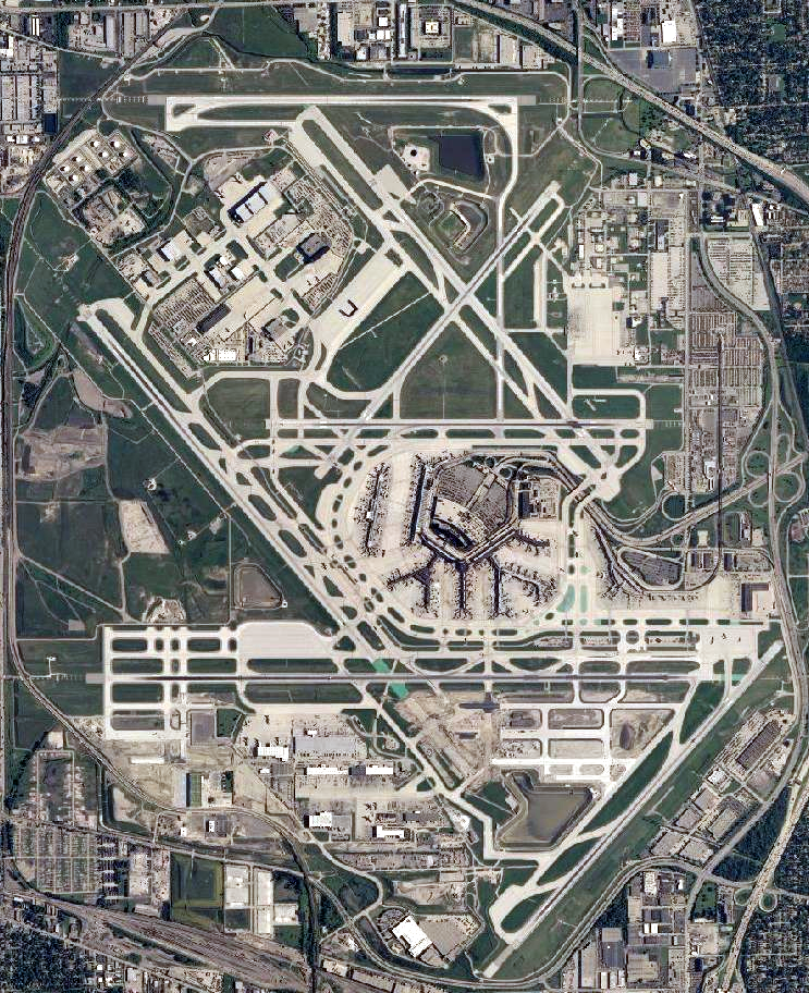
File:O'Hare International Airport (USGS).png
Size of this preview: 488 × 599 pixels. Other resolutions: 195 × 240 pixels | 391 × 480 pixels | 743 × 912 pixels.
Original file (743 × 912 pixels, file size: 1.56 MB, MIME type: image/png)
| This is a file from the Wikimedia Commons. The description on its description page there is shown below.
|
.png)
| Description |
English: Satellite image of Chicago O'Hare International Airport |
|||
| Date | ||||
| Source | USGS National Map Viewer | |||
| Author |
|
File history
Click on a date/time to view the file as it appeared at that time.
| Date/Time | Dimensions | User | Comment | |
|---|---|---|---|---|
| current | 12:51, 29 November 2011 | 743 × 912 (1.56 MB) | Nathan Johnson | color levels |
File usage
There are no pages that use this file.
.png)