File:Otto 2016-11-24 1605Z.jpg
Size of this preview: 450 × 600 pixels. Other resolutions: 180 × 240 pixels | 360 × 480 pixels | 576 × 768 pixels | 768 × 1,024 pixels | 5,100 × 6,800 pixels.
Original file (5,100 × 6,800 pixels, file size: 8.81 MB, MIME type: image/jpeg)
| This is a file from the Wikimedia Commons. The description on its description page there is shown below.
|
Summary
| Description |
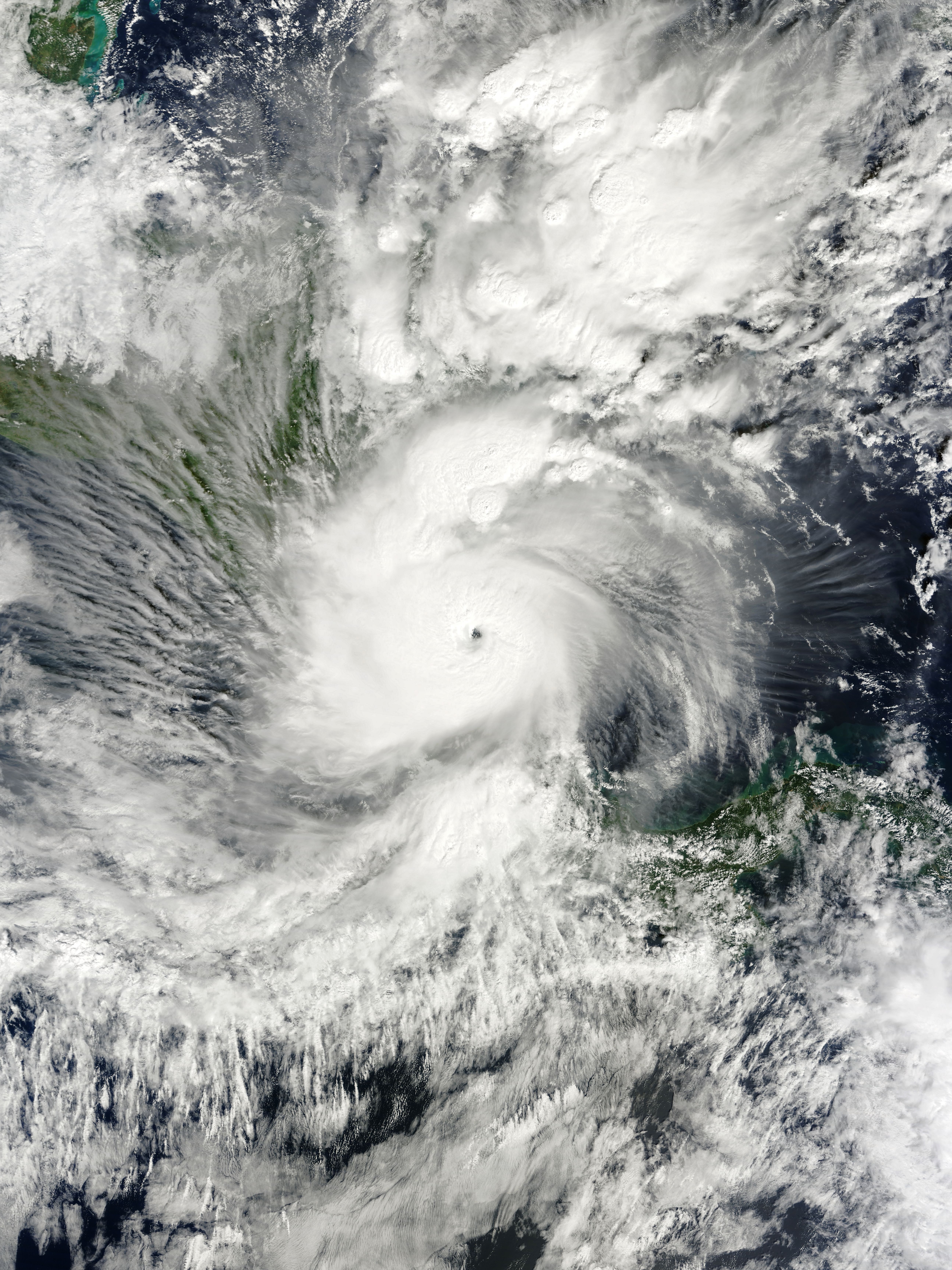
English: Hurricane Otto at peak intensity and immediately before making landfall over the southeast coast of Nicaragua on November 24, 2016. Español: El huracán Otto en su pico de intensidad y antes de tocar tierra sobre la costa sureste de Nicaragua el 24 de noviembre de 2016. |
| Date | |
| Source | EOSDIS Worldview |
| Author | MODIS image captured by NASA’s Terra satellite |
| Camera location | | View this and other nearby images on: OpenStreetMap |
|---|
Licensing
| This file is in the public domain in the United States because it was solely created by NASA. NASA copyright policy states that "NASA material is not protected by copyright unless noted". (See Template:PD-USGov, NASA copyright policy page or JPL Image Use Policy.) | ||
 |
Warnings:
|
File history
Click on a date/time to view the file as it appeared at that time.
| Date/Time | Dimensions | User | Comment | |
|---|---|---|---|---|
| current | 22:20, 7 July 2018 | 5,100 × 6,800 (8.81 MB) | Nino Marakot | Reverted to version as of 08:12, 25 November 2016 (UTC) - Maybe this is the proposed image.... |
File usage
The following 2 pages use this file: