File:Outline Map of Crimea in Russia (2014–2022).svg

Size of this PNG preview of this SVG file: 800 × 542 pixels. Other resolutions: 320 × 217 pixels | 640 × 434 pixels | 1,024 × 694 pixels | 1,280 × 868 pixels | 1,000 × 678 pixels.
Original file (SVG file, nominally 1,000 × 678 pixels, file size: 82 KB)
| This is a file from the Wikimedia Commons. The description on its description page there is shown below.
|
.svg)

|
The boundaries on this map show the de facto situation. This is just one of several different views on the subject (see COM:NPOV). |
Summary
| Description |
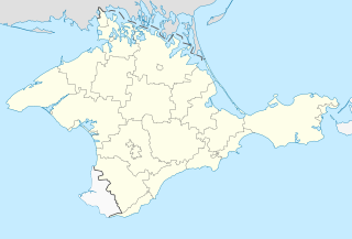
Русский: Позиционная карта Республики Крым (2014—2022)
Равноугольная проекция, стандартная параллель — 45°15′с.ш. Параметры шаблона (координаты краёв): Українська: Позиційна мапа Республіки Крим (2014—2022)
Рівнокутна проєкція, стандартна паралель — 45°15′с.ш. Параметри шаблона (координати країв): English: Location map of the Republic of Crimea (2014—2022)
Conformal projection, standard parallels — 45°15's.W. Template parameters (coordinates of the edges):
|
| Date | |
| Source | https://upload.wikimedia.org/wikipedia/commons/archive/f/f6/20140405143406%21Outline_Map_of_Crimea.svg |
| Author | NoviSadGrad |
Licensing
| This work has been released into the public domain by its author, NoviSagGrad. This applies worldwide. In some countries this may not be legally possible; if so: NoviSagGrad grants anyone the right to use this work for any purpose, without any conditions, unless such conditions are required by law. |
File history
Click on a date/time to view the file as it appeared at that time.
| Date/Time | Dimensions | User | Comment | |
|---|---|---|---|---|
| current | 03:50, 11 May 2014 | 1,000 × 678 (82 KB) | Seryo93 | User created page with UploadWizard |
File usage
There are no pages that use this file.
.svg)