File:Packhorse Bridge and Jacob's Ladder - geograph.org.uk - 616482.jpg
No higher resolution available.
Packhorse_Bridge_and_Jacob's_Ladder_-_geograph.org.uk_-_616482.jpg (640 × 480 pixels, file size: 104 KB, MIME type: image/jpeg)
| This is a file from the Wikimedia Commons. The description on its description page there is shown below.
|
Summary
| Description |
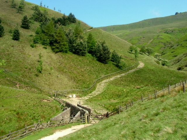
English: Edale below Jacob's Ladder, northwest of Upper Booth, Edale, Derbyshire. The packhorse bridge over the River Noe may be 17th-century. |
| Date | |
| Source | From geograph.org.uk |
| Author | George Tod |
| Attribution (required by the license) | George Tod / Packhorse Bridge and Jacob's Ladder / |
| Camera location | | View this and other nearby images on: OpenStreetMap |
|---|
_heading:315.00&language=en)
| Object location | | View this and other nearby images on: OpenStreetMap |
|---|
_heading:315.00&language=en)
Licensing

|
This image was taken from the Geograph project collection. See this photograph's page on the Geograph website for the photographer's contact details. The copyright on this image is owned by George Tod and is licensed for reuse under the Creative Commons Attribution-ShareAlike 2.0 license.
|
This file is licensed under the Creative Commons Attribution-Share Alike 2.0 Generic license.
Attribution:
George Tod
- You are free:
- to share – to copy, distribute and transmit the work
- to remix – to adapt the work
- Under the following conditions:
- attribution – You must give appropriate credit, provide a link to the license, and indicate if changes were made. You may do so in any reasonable manner, but not in any way that suggests the licensor endorses you or your use.
- share alike – If you remix, transform, or build upon the material, you must distribute your contributions under the same or compatible license as the original.
File history
Click on a date/time to view the file as it appeared at that time.
| Date/Time | Dimensions | User | Comment | |
|---|---|---|---|---|
| current | 19:15, 6 February 2011 | 640 × 480 (104 KB) | GeographBot | == {{int:filedesc}} == {{Information |description={{en|1=Packhorse Bridge and Jacob's Ladder On the route of the Pennine Way, this is the start of the main ascent to Edale Cross.}} |date=2007-06-04 |source=From [http://www.geograph.org.uk/photo/616482 geo |
File usage
The following page uses this file: