File:Ph locator map palawan.png
No higher resolution available.
Ph_locator_map_palawan.png (300 × 440 pixels, file size: 26 KB, MIME type: image/png)
| This is a file from the Wikimedia Commons. The description on its description page there is shown below.
|
Summary
| Description |
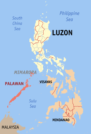
English: Map of the Philippines showing the location of Palawan. Red shade: Palawan Province; Light shade: Luzon Island Group; Orange: Rest of the Philippines |
| Date | |
| Source | English Wikipedia |
| Author | Eugene Alvin Villar (seav) |
Licensing

|
Permission is granted to copy, distribute and/or modify this document under the terms of the GNU Free Documentation License, Version 1.2 or any later version published by the Free Software Foundation; with no Invariant Sections, no Front-Cover Texts, and no Back-Cover Texts. A copy of the license is included in the section entitled GNU Free Documentation License. |
| This file is licensed under the Creative Commons Attribution-Share Alike 3.0 Unported license. | ||
| ||
| This licensing tag was added to this file as part of the GFDL licensing update. |

|
If you choose to use this work under the Creative Commons license stated on this page, the author, Eugene Alvin Villar (seav), would like you to attribute the work to him (among other requirements such as indicating that the work is licensed under the Creative Commons) with the following text or similar:
© Eugene Alvin Villar, 2003
His name should be a link to his Wikimedia Commons userpage. If a link is not possible, then the url should be placed in parentheses after the name. If the work has been substantially altered by other people (see the File history section below), then this particular attribution requirement is waived, which means you can attribute the work in any reasonable manner. This attribution requirement is provided pursuant to the Creative Commons Attribution mechanism where "you must attribute the work in the manner specified by the author or licensor (but not in any way that suggests that they endorse you or your use of the work)." (See "Attribution" in the Creative Commons website.)
|
File history
Click on a date/time to view the file as it appeared at that time.
| Date/Time | Dimensions | User | Comment | |
|---|---|---|---|---|
| current | 06:28, 1 July 2009 | 300 × 440 (26 KB) | Hariboneagle927 | Palawan is in the MIMAROPA region references: http://en.wikipedia.org/wiki/MIMAROPA |
File usage
There are no pages that use this file.