File:Slovakia1941 02.png
Size of this preview: 794 × 600 pixels. Other resolutions: 318 × 240 pixels | 636 × 480 pixels | 997 × 753 pixels.
Original file (997 × 753 pixels, file size: 50 KB, MIME type: image/png)
| This is a file from the Wikimedia Commons. The description on its description page there is shown below.
|
Summary
| Description |
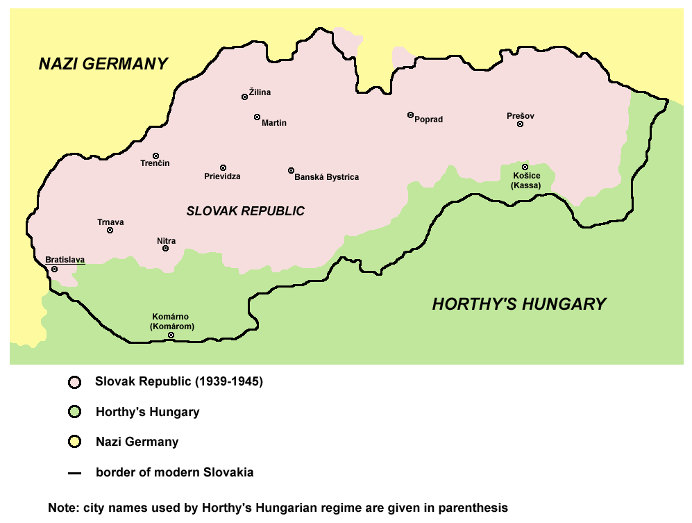
English: historic map of Slovak Republic (1939-1945) |
| Date | 28 December 2006 (original upload date) |
| Source | Own work |
| Author | PANONIAN |
| Other versions |
[]
|


.png)

References
Published references:
- The Times History of Europe, Times Books, London, 2002.
- Richard Overy, The Times History of the 20th Century, Times Books, London, 2003.
- Istorijski atlas, Zavod za udžbenike i nastavna sredstva - Zavod za kartografiju "Geokarta", Beograd, 1999.
- Peter Rokai - Zoltan Đere - Tibor Pal - Aleksandar Kasaš, Istorija Mađara, Beograd, 2002.
Internet references:
Licensing
self made map by user:PANONIAN

|
This map has been uploaded by Electionworld from en.wikipedia.org to enable the |
| I, the copyright holder of this work, release this work into the public domain. This applies worldwide. In some countries this may not be legally possible; if so: I grant anyone the right to use this work for any purpose, without any conditions, unless such conditions are required by law. |
derivative works
Derivative works of this file:
File history
Click on a date/time to view the file as it appeared at that time.
| Date/Time | Dimensions | User | Comment | |
|---|---|---|---|---|
| current | 02:43, 29 April 2011 | 997 × 753 (50 KB) | Piastu | Reverted to version as of 10:58, 5 March 2011 |
File usage
There are no pages that use this file.