File:Speed Engineering School, Louisville, Kentucky (1067).jpg
No higher resolution available.
Speed_Engineering_School,_Louisville,_Kentucky_(1067).jpg (611 × 449 pixels, file size: 79 KB, MIME type: image/jpeg)
| This is a file from the Wikimedia Commons. The description on its description page there is shown below.
|
.jpg)
|
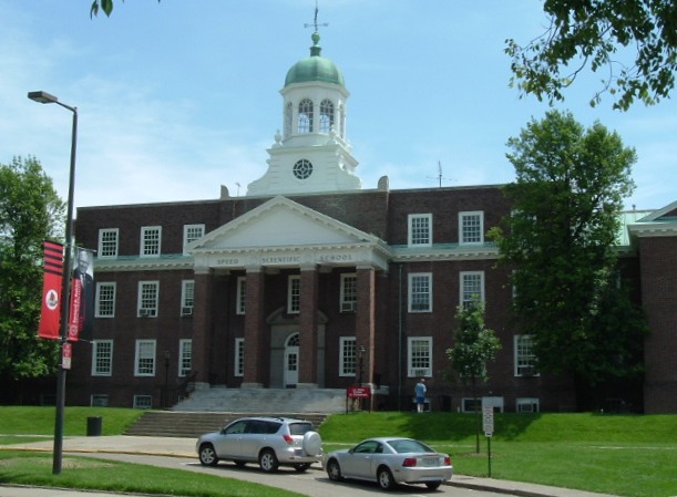
This is an image of a place or building that is listed on the National Register of Historic Places in the United States of America. Its reference number is 76000908. |
Summary
| Description | Speed Engineering School. Louisville, Kentucky |
| Date | 6. Jun. 2006 (Original upload date) |
| Source | http://en.wikipedia.org/wiki/Image:Picture_1067.jpg |
| Author | Taken and uploaded by Jeffrey B. Morris on 6-6-06 |
| Object location | | View this and other nearby images on: OpenStreetMap |
|---|
.jpg¶ms=038.215556_N_-085.760556_E_globe:Earth_class:object_region:US_type:landmark_scale:1500_&language=en)
Licensing
| This work has been released into the public domain by its author, Brando03 at English Wikipedia. This applies worldwide. In some countries this may not be legally possible; if so: Brando03 grants anyone the right to use this work for any purpose, without any conditions, unless such conditions are required by law. |
Original upload log
| date/time | username | resolution | size | edit summary |
|---|---|---|---|---|
| 18:48, 13 March 2008 | User:Sylfred1977 | 640×480 | 128 KB | <span class="comment">({{Information |Description=Speed Engineering School. Louisville, Kentucky |Source=http://en.wikipedia.org/wiki/Image:Picture_1067.jpg |Date=13-03-2008 |Author=Taken and uploaded by Jeffrey B. Morris on 6-6-06 |Permission= |other_versions= }} [[Category:U)</span> |
File history
Click on a date/time to view the file as it appeared at that time.
| Date/Time | Dimensions | User | Comment | |
|---|---|---|---|---|
| current | 13:04, 14 April 2008 | 611 × 449 (79 KB) | GeorgHH | rotation three degrees left, cropped |
File usage
The following page uses this file:
.jpg)