File:Trinitarian Church of Bratislava (10267484535).jpg
Size of this preview: 800 × 531 pixels. Other resolutions: 320 × 213 pixels | 640 × 425 pixels | 1,024 × 680 pixels | 1,280 × 850 pixels | 4,288 × 2,848 pixels.
Original file (4,288 × 2,848 pixels, file size: 3.24 MB, MIME type: image/jpeg)
| This is a file from the Wikimedia Commons. The description on its description page there is shown below.
|
.jpg)
Summary
| Description |
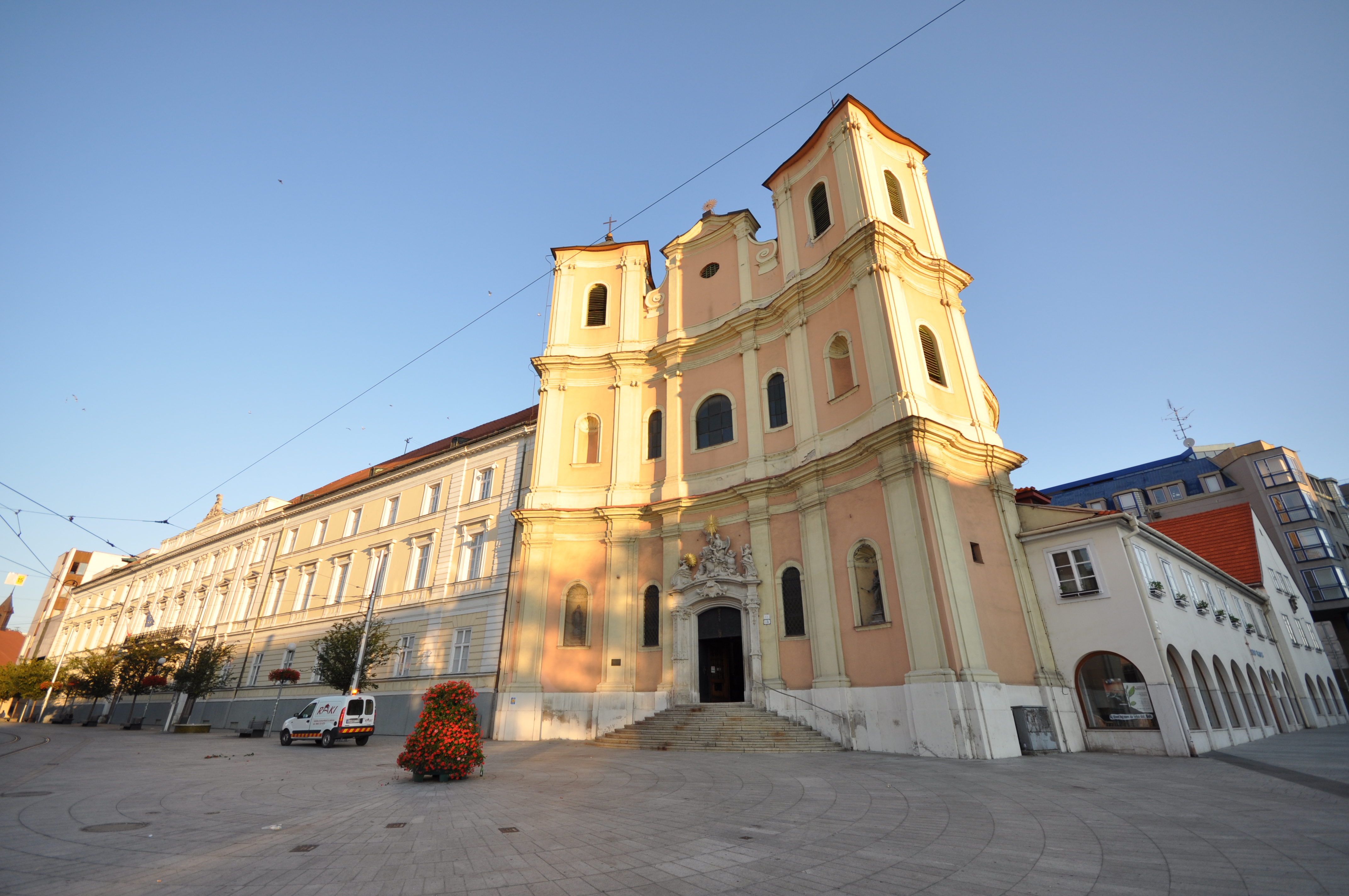
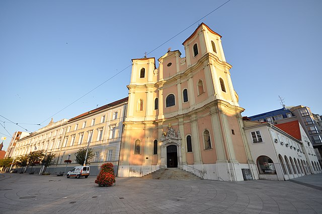
The Trinitarian Church or Trinity Church, full name Church of Saint John of Matha and Saint Felix of Valois (Slovak: Kostol trinitárov, Trinitársky kostol or Trojičný kostol or Kostol svätého Jána z Mathy a svätého Felixa z Valois; incorrectly Holy Trinity Church (Kostol Najsvätejšej Trojice)), is a Baroque-style church in Bratislava's Old Town borough, on the Župné námestie square. The church was built on the site of the older Church of St. Michael, which was demolished in 1529, along with the settlement of St. Michael, during the Ottoman wars, along with other suburbs, so as to see better the attacking Turks. The Trinitarian Order started construction of the church in 1717 and it was sanctified in 1727, although work in the interior continued into the first half of the 18th century [Wikipedia.org] |
| Date | |
| Source | Trinitarian Church of Bratislava |
| Author | Jorge Láscar from Australia |
| Camera location | | View this and other nearby images on: OpenStreetMap |
|---|
.jpg¶ms=048.146111_N_0017.106667_E_globe:Earth_type:camera_source:Flickr_&language=en)
Licensing
This file is licensed under the Creative Commons Attribution 2.0 Generic license.
- You are free:
- to share – to copy, distribute and transmit the work
- to remix – to adapt the work
- Under the following conditions:
- attribution – You must give appropriate credit, provide a link to the license, and indicate if changes were made. You may do so in any reasonable manner, but not in any way that suggests the licensor endorses you or your use.
| This image was originally posted to Flickr by Jorge Lascar at https://www.flickr.com/photos/8721758@N06/10267484535. It was reviewed on 2 April 2014 by FlickreviewR and was confirmed to be licensed under the terms of the cc-by-2.0. |
File history
Click on a date/time to view the file as it appeared at that time.
| Date/Time | Dimensions | User | Comment | |
|---|---|---|---|---|
| current | 23:34, 1 April 2014 | 4,288 × 2,848 (3.24 MB) | Russavia | Transferred from Flickr |
File usage
The following page uses this file:
.jpg)