File:Tropical Storm Hanna (2002).jpg
No higher resolution available.
Tropical_Storm_Hanna_(2002).jpg (642 × 482 pixels, file size: 53 KB, MIME type: image/jpeg)
| This is a file from the Wikimedia Commons. The description on its description page there is shown below.
|
.jpg)
Summary
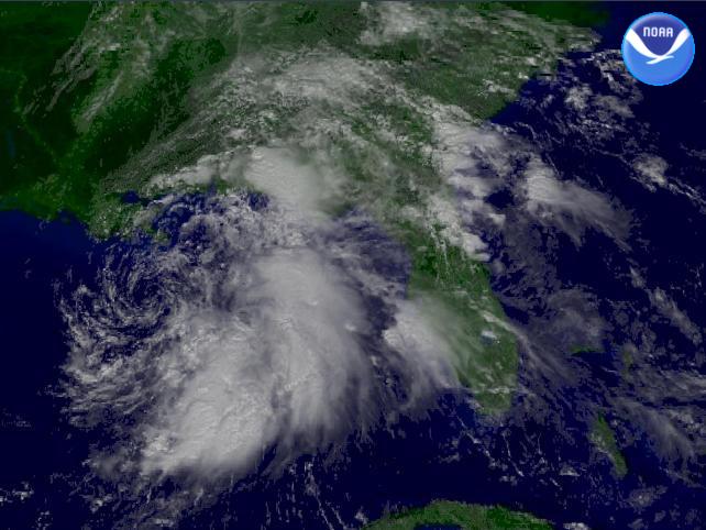
| Description | The National Weather Service's Tropical Prediction Center shows Tropical Storm Hanna 105 miles south-southwest of the mouth of the Mississippi River. Winds are sustained at 45 MPH with stronger gusts. | |||
| Date | ||||
| Source | http://www.nnvl.noaa.gov/cgi-bin/index.cgi?page=items&ser=104823 | |||
| Author | NOAA / Satellite and Information Service | |||
| Permission (Reusing this file) |
|
File history
Click on a date/time to view the file as it appeared at that time.
| Date/Time | Dimensions | User | Comment | |
|---|---|---|---|---|
| current | 11:28, 12 November 2006 | 642 × 482 (53 KB) | Good kitty |
File usage
The following page uses this file:
.jpg)