File:US map-Arklatex.PNG
No higher resolution available.
US_map-Arklatex.PNG (572 × 371 pixels, file size: 19 KB, MIME type: image/png)
| This is a file from the Wikimedia Commons. The description on its description page there is shown below.
|

Summary

|
This map image could be re-created using vector graphics as an SVG file. This has several advantages; see Commons:Media for cleanup for more information. If an SVG form of this image is available, please upload it and afterwards replace this template with
{{vector version available|new image name}}.
It is recommended to name the SVG file “US map-Arklatex.svg”—then the template Vector version available (or Vva) does not need the new image name parameter. |
| Description |
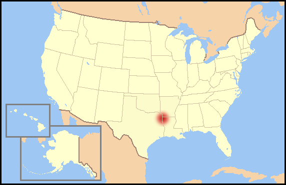
English: Map of the United States highlighting the Arklatex, in the suggested style by wikiproject maps, using the existing template of wikiproject US regions. |
| Date | 23 May 2006 (original upload date) |
| Source | Transferred from en.wikipedia to Commons by CPacker using CommonsHelper. |
| Author | JCarriker at English Wikipedia |
Licensing
JCarriker at the English-language Wikipedia, the copyright holder of this work, hereby publishes it under the following license:
| This file is licensed under the Creative Commons Attribution-Share Alike 3.0 Unported license. Subject to disclaimers. | ||
| Attribution: JCarriker at the English-language Wikipedia | ||
| ||
| This licensing tag was added to this file as part of the GFDL licensing update. |

|
Permission is granted to copy, distribute and/or modify this document under the terms of the GNU Free Documentation License, Version 1.2 or any later version published by the Free Software Foundation; with no Invariant Sections, no Front-Cover Texts, and no Back-Cover Texts. A copy of the license is included in the section entitled GNU Free Documentation License. Subject to disclaimers. |
Original upload log
The original description page was here. All following user names refer to en.wikipedia.
- 2006-05-23 02:28 JCarriker 572×371×??? (19182 bytes) Map of the United States highlighting the [[Arklatex]], in the suggested style by wikiproject maps, using the existing template of [[WP:USR|wikiproject US regions]].
File history
Click on a date/time to view the file as it appeared at that time.
| Date/Time | Dimensions | User | Comment | |
|---|---|---|---|---|
| current | 17:25, 9 September 2008 | 572 × 371 (19 KB) | File Upload Bot (Magnus Manske) | {{BotMoveToCommons|en.wikipedia}} {{Information |Description={{en|Map of the United States highlighting the en:Arklatex, in the suggested style by wikiproject maps, using the existing template of wikiproject US regions.}} |Source=Tran |
File usage
The following page uses this file: