File:Volgograd 44.67670E 48.66724N.jpg

Size of this preview: 800 × 599 pixels. Other resolutions: 320 × 240 pixels | 640 × 479 pixels | 1,024 × 766 pixels | 1,280 × 958 pixels.
Original file (1,280 × 958 pixels, file size: 262 KB, MIME type: image/jpeg)
| This is a file from the Wikimedia Commons. The description on its description page there is shown below.
|
Summary
| Description |
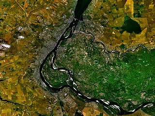
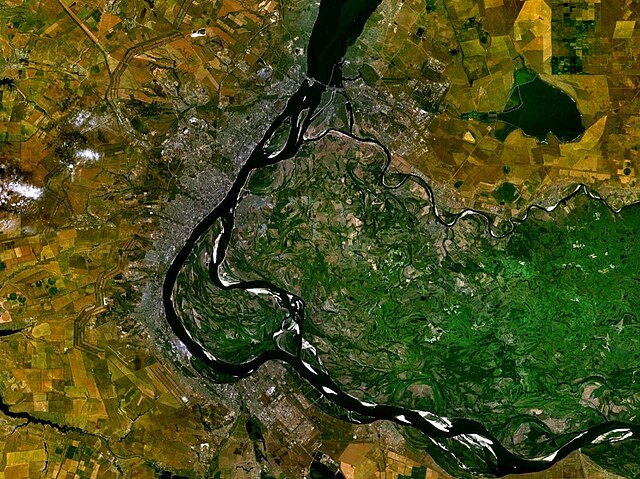
English: Volgograd, Russia |
| Date | 19 May 2005 (upload date) |
| Source | Satellite imagery taken from NASA World Wind software (by screenshot) |
| Author | NASA |
| Object location | | View this and other nearby images on: OpenStreetMap |
|---|
Licensing
| This image is in the public domain because it is a screenshot from NASA’s globe software World Wind using a public domain layer, such as Blue Marble, MODIS, Landsat, SRTM, USGS or GLOBE.
|
 |
File history
Click on a date/time to view the file as it appeared at that time.
| Date/Time | Dimensions | User | Comment | |
|---|---|---|---|---|
| current | 11:44, 19 May 2005 | 1,280 × 958 (262 KB) | Rex | Volgograd, Russia {{World Wind}} Category:Maps of Russia |
File usage
The following page uses this file: