File:Wien - Millennium Tower (1).JPG
Size of this preview: 400 × 600 pixels. Other resolutions: 160 × 240 pixels | 320 × 480 pixels | 512 × 768 pixels | 683 × 1,024 pixels | 3,024 × 4,535 pixels.
Original file (3,024 × 4,535 pixels, file size: 9.82 MB, MIME type: image/jpeg)
| This is a file from the Wikimedia Commons. The description on its description page there is shown below.
|
Summary
| Description |
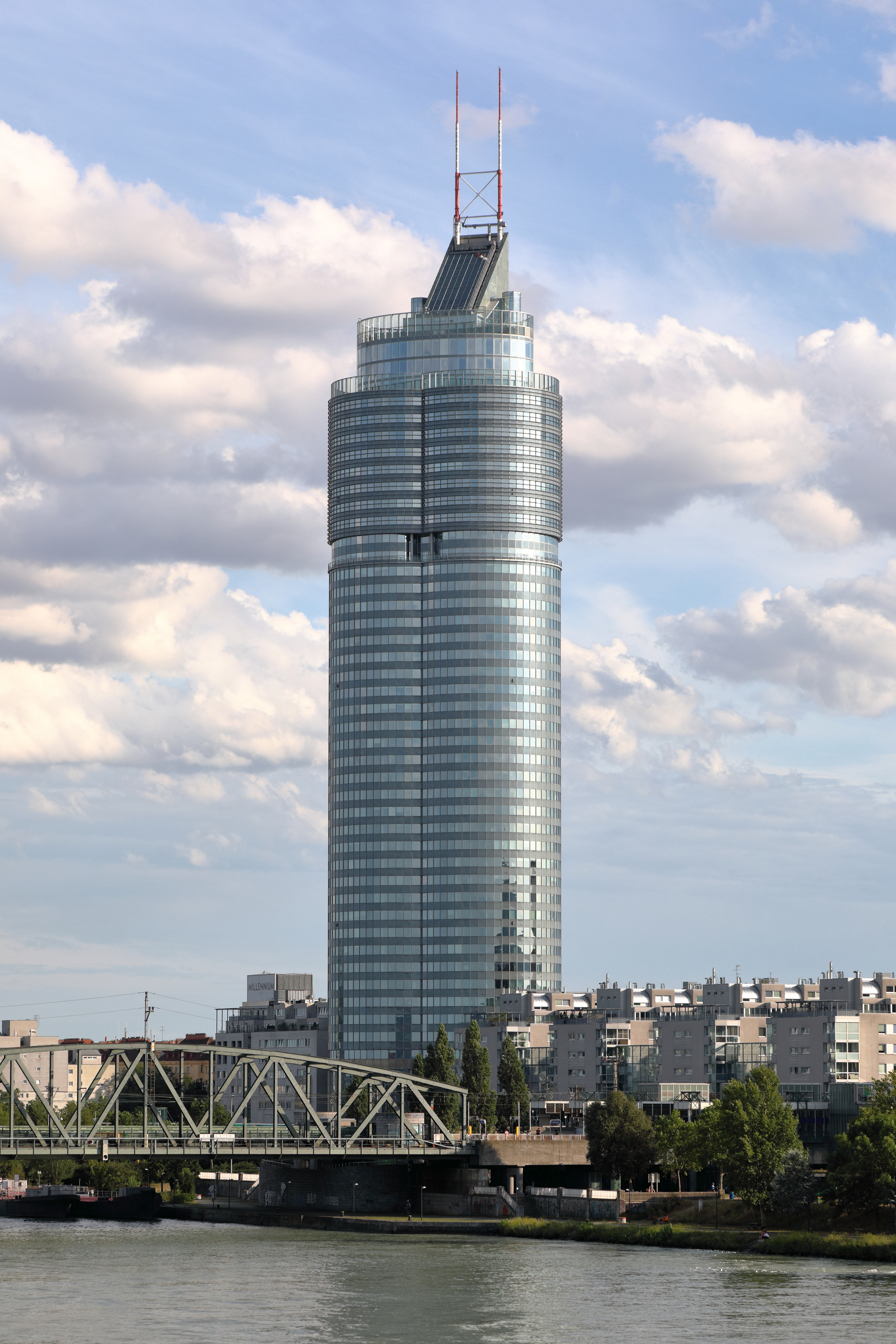
Deutsch: Der Millennium Tower im 20. Wiener Gemeindebezirk Brigittenau von der Floridsdorfer Brücke aus gesehen. Das Büro- und Wohnhochhaus wurde von 1997 bis 1999 nach Plänen der Architekten Gustav Peichl, Boris Podrecca und Rudolf F. Weber für den Bauherrn Georg Stumpf mit einem Kostenaufwand von rd. 210 Millionen Euro errichtet. Das Gebäude hat eine Gesamthöhe von 202 Meter (Dachfirst 160 Meter) und ist damit nach dem Donauturm (252 Meter) und dem ersten Hochhaus der DC Towers (250 Meter) das dritthöchste Gebäude Wiens. Der Tower hat über 50 Geschosse, rund 47.200 Quadratmeter Büro- und 30.000 Quadratmeter Wohnfläche sowie 14.000 Quadratmeter für Dienstleistungs- beziehungsweise 10.000 Quadratmeter für Einzelhandelsbetriebe. |
| Date | |
| Source | Own work |
| Author | C.Stadler/Bwag |
| Permission (Reusing this file) |
Deutsch: Hallo, du darfst mein Foto kostenlos nutzen, aber nenne mich bitte als Fotograf, beispielsweise „Foto: C.Stadler/Bwag“ oder © C.Stadler/Bwag; CC-BY-SA-4.0. Auf mehr Angaben bestehe ich nicht - im Gegensatz zu manch anderen, die die Vorgaben der unten angeführten Lizenzierung auf Punkt und Beistrich einfordern. English: Feel free to use my photos, but please mention me as the author like © C.Stadler/Bwag or © C.Stadler/Bwag; CC-BY-SA-4.0 (that's good enough) and if you want send me a message: bwag@gmx.net. |
| Other versions |
|
.JPG)
.JPG)
| Object location | | View this and other nearby images on: OpenStreetMap |
|---|
.JPG¶ms=048.240200_N_0016.387120_E_globe:Earth_class:object_type:object__&language=en)
| Camera location | | View this and other nearby images on: OpenStreetMap |
|---|
.JPG¶ms=048.247070_N_0016.384590_E_globe:Earth_type:camera_heading:165.00&language=en)
Licensing
I, the copyright holder of this work, hereby publish it under the following license:
This file is licensed under the Creative Commons Attribution-Share Alike 4.0 International license.
- You are free:
- to share – to copy, distribute and transmit the work
- to remix – to adapt the work
- Under the following conditions:
- attribution – You must give appropriate credit, provide a link to the license, and indicate if changes were made. You may do so in any reasonable manner, but not in any way that suggests the licensor endorses you or your use.
- share alike – If you remix, transform, or build upon the material, you must distribute your contributions under the same or compatible license as the original.

|
Diese Datei wurde im Rahmen von WikiDaheim 2019 in Österreich erstellt und hochgeladen. Sie wurde dem allgemeinen Themenbereich zugeordnet. |
File history
Click on a date/time to view the file as it appeared at that time.
| Date/Time | Dimensions | User | Comment | |
|---|---|---|---|---|
| current | 13:08, 8 August 2019 | 3,024 × 4,535 (9.82 MB) | Bwag | {{Information |Description= {{de|1= Der Millennium Tower im 20. Wiener Gemeindebezirk Brigittenau von der Floridsdorfer Brücke aus gesehen.<br/>Das Büro- und Wohnhochhaus wurde von 1997 bis 1999 nach Plänen der Architekten Gustav Peichl, Boris Podrecca und Rudolf F. Weber für den Bauherrn Georg Stumpf mit einem Kostenaufwand von rd. 210 Millionen Euro errichtet. Das Gebäude hat eine Ge... |
File usage
The following page uses this file:
.JPG)