File:Zugspitze Airview 01.jpg

Original file (2,814 × 2,111 pixels, file size: 4.12 MB, MIME type: image/jpeg)
| This is a file from the Wikimedia Commons. The description on its description page there is shown below.
|
Summary
| Description |
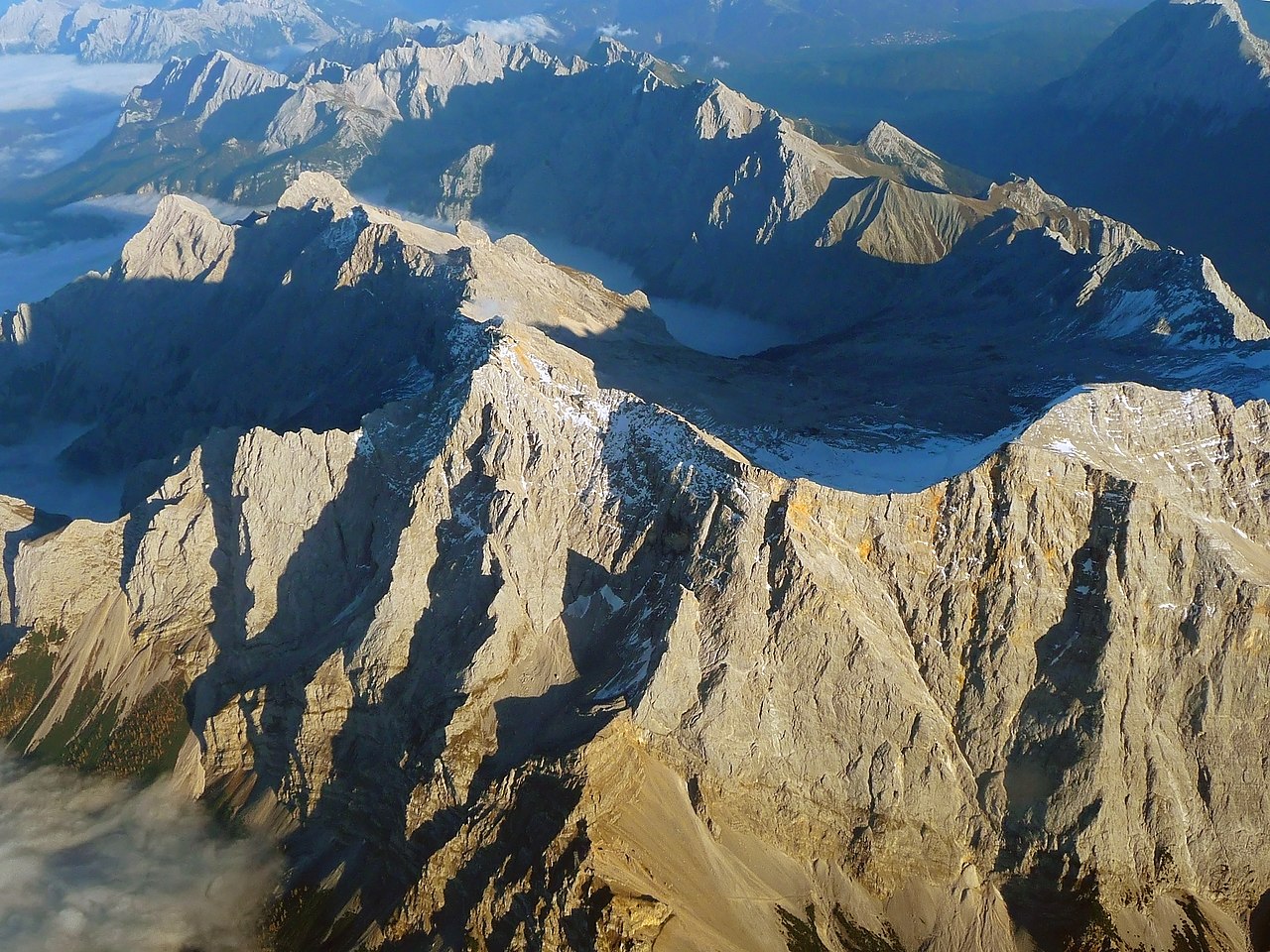
English: The "Zugspitze", the highest mountain in Germany as seen from an aircraft. View from West, with mountains in Wetterstein around and valley Reintal with fog or clouds from above.
Deutsch: Die "Zugspitze", der höchste Berg Deutschlands aus einem Flugzeug gesehen. Der Hauptgipfel des Wettersteingebirges ist umgeben von tieferliegenden Graten wie dem Jubiläumsgrat, dem Schneefernerkopf rechts neben dem Gipfel in der Mitte, mit dem Zugspitzplatt und dem steil abfallenden Reintal dahinter, die beide bereits im Schatten des späten Nachmittags liegen. Oktober mit Sonne auf dem Gipfel. |
| Date | |
| Source | Own work |
| Author | Africaspotter |
| Camera location | | View this and other nearby images on: OpenStreetMap |
|---|
Licensing
- You are free:
- to share – to copy, distribute and transmit the work
- to remix – to adapt the work
- Under the following conditions:
- attribution – You must give appropriate credit, provide a link to the license, and indicate if changes were made. You may do so in any reasonable manner, but not in any way that suggests the licensor endorses you or your use.
- share alike – If you remix, transform, or build upon the material, you must distribute your contributions under the same or compatible license as the original.
1. Online-Medien:
2. Print-Medien:
Ich bitte um Zusendung eines Belegexemplares bzw. der URL, wo das Foto benutzt wird. Bitte schreiben Sie eine E-Mail, wenn Sie meine Adresse für die Zusendung eines Belegexemplares benötigen oder weitergehende Fragen zur Lizenznutzung haben. Eine Auswahl meiner Fotos finden Sie auch auf www.felixgottwald.net. |
1. Online media:
2. Print media:
Please send me a specimen copy or the URL of the website where the image is used. Please write an email, if you need my postal address for sending a specimen copy or have further questions regarding the terms of licence. You may also find a selection of my photos at www.felixgottwald.net. |
| Annotations | This image is annotated: View the annotations at Commons |
File history
Click on a date/time to view the file as it appeared at that time.
| Date/Time | Dimensions | User | Comment | |
|---|---|---|---|---|
| current | 12:00, 13 October 2010 | 2,814 × 2,111 (4.12 MB) | Africaspotter | {{Information |Description={{en|1=The "Zugspitze", the highest mountain in Germany as seen from an aircraft.}} {{de|1=Die "Zugspitze", der höchste Berg Deutschlands aus einem Flugzeug gesehen.}} |Source={{own}} |Author=[[User:Africaspotter|Africaspotter] |
File usage
The following page uses this file: