File:Myanmar Disaster Topography.png

Size of this preview: 444 × 599 pixels. Other resolutions: 178 × 240 pixels | 356 × 480 pixels | 445 × 600 pixels | 1,000 × 1,349 pixels.
Original file (1,000 × 1,349 pixels, file size: 592 KB, MIME type: image/png)
| This is a file from the Wikimedia Commons. The description on its description page there is shown below.
|
| Description |
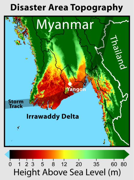
This map shows the elevation of those regions of Myanmar hardest hit by Cyclone Nargis. The track of the cyclone's eye is indicated. The low lying Irrawaddy Delta was among the hardest hit regions and was affected by both flooding and storm surge. Elevation data is based on NASA SRTM. Additional elevation imagery available at GWArt |
|||
| Date | ||||
| Source | Own work | |||
| Author | Robert A. Rohde | |||
| Permission (Reusing this file) |
|

File history
Click on a date/time to view the file as it appeared at that time.
| Date/Time | Dimensions | User | Comment | |
|---|---|---|---|---|
| current | 23:10, 7 May 2008 | 1,000 × 1,349 (592 KB) | Dragons flight | {{Information |Description=This map shows the elevation of those regions of w:Myanmar hardest hit by w:Cyclone Nargis. The track of the cyclone's eye is indicated. The low lying w:Irrawaddy Delta was among the hardest hit regions affected |
File usage
The following page uses this file: