File:Thurrock UK locator map.svg

Size of this PNG preview of this SVG file: 749 × 600 pixels. Other resolutions: 300 × 240 pixels | 600 × 480 pixels | 959 × 768 pixels | 1,279 × 1,024 pixels | 1,425 × 1,141 pixels.
Original file (SVG file, nominally 1,425 × 1,141 pixels, file size: 1.41 MB)
| This is a file from the Wikimedia Commons. The description on its description page there is shown below.
|
| Description | Equirectangular map projection on WGS 84 datum, with N/S stretched 160% |
| Date | |
| Source |
|
| Author | Nilfanion, created using Ordnance Survey data |
| Permission (Reusing this file) |
This file is licensed under the Creative Commons Attribution-Share Alike 3.0 Unported license. Attribution: Contains Ordnance Survey data © Crown copyright and database right
|
File history
Click on a date/time to view the file as it appeared at that time.
| Date/Time | Dimensions | User | Comment | |
|---|---|---|---|---|
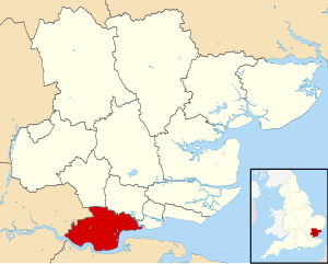
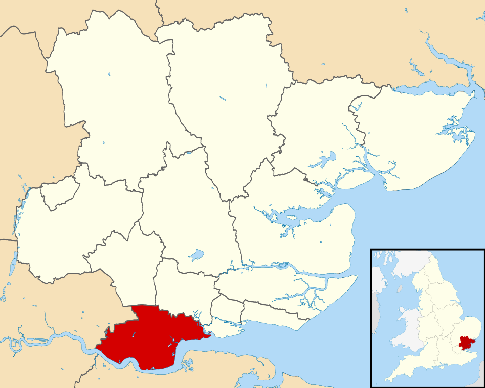
| current | 16:15, 3 August 2011 | 1,425 × 1,141 (1.41 MB) | Nilfanion | {{Information |Description=Map of Essex, UK with Thurrock highlighted. Equirectangular map projection on WGS 84 datum, with N/S stretched 160% |Source=Ordnance Survey [https://www.ordnancesurvey.co.uk/open |
File usage
The following page uses this file: