Ordnance Survey
The Ordnance Survey (OS) is an organisation that creates maps of Great Britain. The OS head office is in Southampton in England. They are an agency of the Government of the United Kingdom.[1]
Ordnance Survey Media
Grid square TF from the Ordnance Survey National Grid, shown at a scale of 1:250,000. The map shows the Wash and the North Sea, as well as places within the counties of Lincolnshire, Cambridgeshire and Norfolk.
Pollokshaws on Roy's Military Survey of Scotland (1747–1755)
Detail from 1901 Ordnance Survey map of the Imperial fortress colony of Bermuda (showing St. George's Town and St. George's Garrison), compiled from surveys carried out between 1897 and 1899 by Lieutenant Arthur Johnson Savage, Royal Engineers.
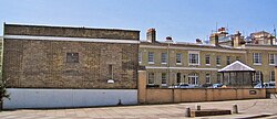
The former headquarters of the Ordnance Survey in London Road, Southampton (2005)
Former Ordnance Survey headquarters in Maybush, Southampton, used from 1969 until 2011
References
- ↑ "Who we are". Crown.


