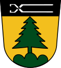
Altenthann
Altenthann is a village and municipality in Regensburg in Bavaria in Germany.
 | |
| Coordinates: 49°5′34″N 12°18′13″E / 49.09278°N 12.30361°ECoordinates: 49°5′34″N 12°18′13″E / 49.09278°N 12.30361°E | |
| Country | Germany |
| State | Bavaria |
| Admin. region | Oberpfalz |
| District | Regensburg |
| Municipal assoc. | Donaustauf |
| Government | |
| • Mayor (2020–26) | Harald Herrmann[1] (FW) |
| Area | |
| • Total | 21.27 km2 (8.21 sq mi) |
| Elevation | 508 m (1,667 ft) |
| Population (2016-12-31)[2] | |
| • Total | 1,517 |
| • Density | 71.32/km2 (184.72/sq mi) |
| Time zone | UTC+01:00 (CET) |
| • Summer (DST) | UTC+02:00 (CEST) |
| Postal codes | 93177 |
| Vehicle registration | R |
| Website | www.altenthann.de |
Geography
Place
Altenthann is in Regensburg, about 18 kilometres northwest of the town of Wörth an der Donau.
Subdivisions
There are 50 subdivisions within the municipality:[3]
|
|
|
There are the districts of Altenthann, Forstmühler Forst, Göppenbach, Lichtenwald and Pfaffenfang.
Altenthann Media
References
- ↑ Liste der ersten Bürgermeister/Oberbürgermeister in kreisangehörigen Gemeinden, Bayerisches Landesamt für Statistik, 15 July 2021.
- ↑ "Fortschreibung des Bevölkerungsstandes". Bayerisches Landesamt für Statistik und Datenverarbeitung (in German). January 2018.
{{cite web}}: CS1 maint: unrecognized language (link) - ↑ Gemeinde Altenthann in the location database of the Bavarian State Library Online. Bavarian State Library, retrieved 27 November 2017
Literature
- Klaus Völger: Petrographie und Tektonik anatektischer Gesteine im Gebiet Wenzenbach-Altenthann. Dissertation, TU Berlin, 1958.


