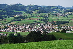
Bütschwil-Ganterschwil
Bütschwil-Ganterschwil is a municipality in Toggenburg in the canton of St. Gallen in Switzerland. On 1 January 2013, the municipalities Bütschwil and Ganterschwil joined together to become this new municipality, Bütschwil-Ganterschwil.[1]
 | |
Location of Bütschwil-Ganterschwil
Lua error in Module:Infobox_mapframe at line 118: attempt to index field 'wikibase' (a nil value).
| |
| Coordinates: 47°21′N 9°4′E / 47.350°N 9.067°ECoordinates: 47°21′N 9°4′E / 47.350°N 9.067°E | |
| Country | Switzerland |
| Canton | St. Gallen |
| District | Toggenburg |
| Area | |
| • Total | 21.81 km2 (8.42 sq mi) |
| Elevation | 610 m (2,000 ft) |
| Highest elevation (Sedelberg) | 942 m (3,091 ft) |
| Lowest elevation | 555 m (1,821 ft) |
| Population (December 2017) | |
| • Total | 4,729 |
| • Density | 216.83/km2 (561.58/sq mi) |
| Time zone | UTC+01:00 (Central European Time) |
| • Summer (DST) | UTC+02:00 (Central European Summer Time) |
| Postal code(s) | |
| Localities | Dietfurt, Langensteig, Kengelbach, Grämigen, Bütschwil, Ganterschwil |
| Surrounded by | Lütisburg, Mosnang, Wattwil, Lichtensteig, Oberhelfenschwil, Neckertal |
| Website | www SFSO statistics |
Bütschwil-Ganterschwil Media
References
- ↑ Amtliches Gemeindeverzeichnis der Schweiz published by the Swiss Federal Statistical Office (in German) accessed 2 January 2013
Other websites
![]() Media related to Bütschwil-Ganterschwil at Wikimedia Commons
Media related to Bütschwil-Ganterschwil at Wikimedia Commons
- Official website of the municipality Bütschwil-Ganterschwil (in German)
- Bütschwil-Ganterschwil in German, French and Italian in the online Historical Dictionary of Switzerland.
- Bütschwil in German, French and Italian in the online Historical Dictionary of Switzerland.
- Ganterschwil in German, French and Italian in the online Historical Dictionary of Switzerland.


