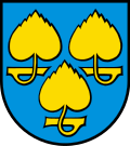
Baldingen, Aargau
Baldingen is a municipality of the district Zurzach in canton of Aargau in Switzerland.
Location of Baldingen
Lua error in Module:Infobox_mapframe at line 118: attempt to index field 'wikibase' (a nil value).
| |
| Coordinates: 47°33′N 8°19′E / 47.550°N 8.317°ECoordinates: 47°33′N 8°19′E / 47.550°N 8.317°E | |
| Country | Switzerland |
| Canton | Aargau |
| District | Zurzach |
| Area | |
| • Total | 2.82 km2 (1.09 sq mi) |
| Elevation | 548 m (1,798 ft) |
| Population (2005) | |
| • Total | 266 |
| • Density | 94.3/km2 (244.3/sq mi) |
| Time zone | UTC+01:00 (Central European Time) |
| • Summer (DST) | UTC+02:00 (Central European Summer Time) |
| Postal code(s) | 5333 |
| Surrounded by | Böbikon, Endingen, Lengnau, Rekingen, Tegerfelden, Unterendingen |
| Website | www |
Baldingen, Aargau Media
Aerial view from 2000 m by Walter Mittelholzer (1923)
References
Other websites
![]() Media related to Baldingen at Wikimedia Commons
Media related to Baldingen at Wikimedia Commons


